


A significant severe weather outbreak is imminent across much of the state of Alabama over the next 36 hours.
In Alabama for today and tonight, the moderate risk extends as far south as a line from Eutaw to Tuscaloosa to Warrior to Snead to Scottsboro. The slight risk area covers the rest of the state as far south as Mobile, Andalusia and Eufaula.
A PDS Tornado Watch was recently issued for much of the Tennessee Valley and Northwest Alabama. It goes until 9 p.m.
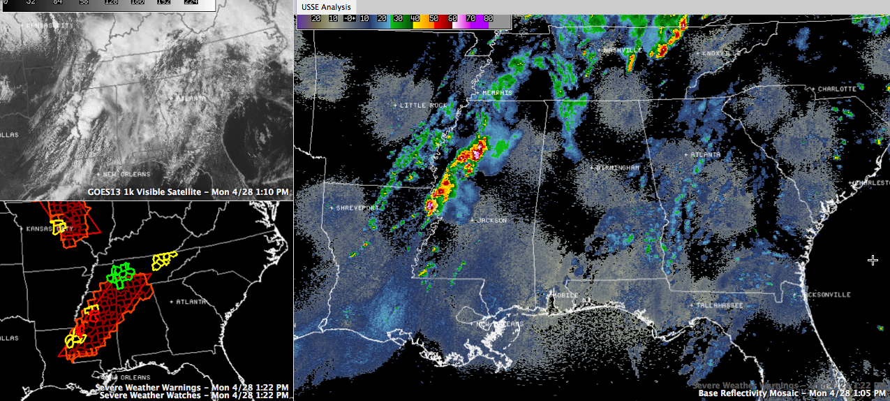
Big thunderstorms have fire up now over the Delta region of western Mississippi. Two tornado warnings are in effect now in western Mississippi.
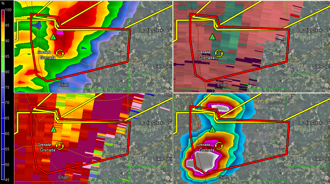
The meanest storm is near Grenada. That storm shows increasing signs of rotation at 1:16 and 2 inch hail and could produce a tornado at any moment if it isn’t already.
This activity will continue moving northeast at 55 mph and will reach Northwest Alabama’s Frankin, COlbert and Lauderdale Counties between 3:15-3:45 p.m.
Another mean storm is west and northwest of Yazoo City. This activity could reach Marion County between 3:30 and 4:30 p.m.
More storms will fire through the afternoon and a broken line of supercells will push eastward through the afternoon, effectively pushing southeastward into the I-59 corridor this evening and southeast of Birmingham sometime around midnight.
This activity should be out of the area entirely by mid morning tomorrow, but we won’t be done with this system. More severe storms, including possible tornadoes, will form tomorrow. In fact, the SPC has upgraded much of the state to a moderate risk outlook tomorrow, including an area bounded by Florence, Huntsville, Jacksonville, Evergreem Foley and Mobile.



