


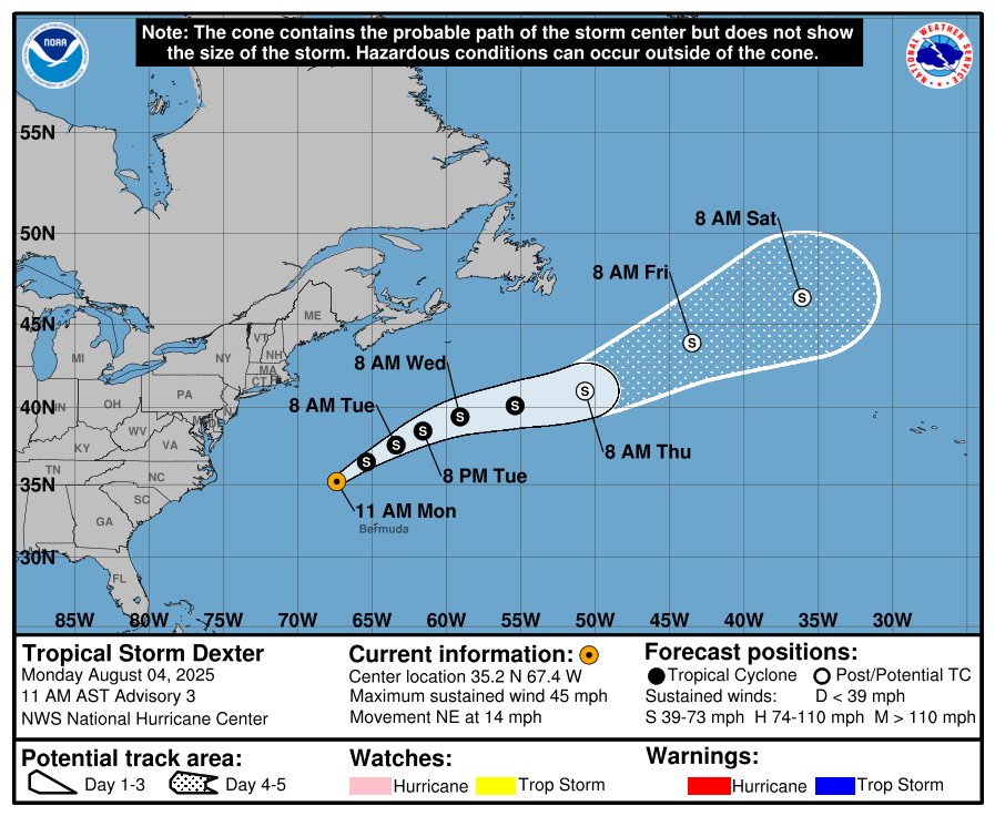
The National Hurricane Center has issued a new discussion for Tropical Storm Dexter, which continues to move away from the U.S. coast. As of 10:00 AM CDT, the storm was moving northeastward a bit faster at 14 mph. Its center is partially exposed, but several bursts of deep convection have formed this morning. Dexter is being steered by a narrow subtropical ridge to its southeast, and this general motion is forecast to continue for the next couple of days with a brief slowdown.
Dexter is facing an increasingly hostile environment with westerly vertical wind shear increasing above 30 knots. Despite this, only a little additional strengthening is expected today, with its intensity capping at 50 mph through the rest of the week, as the cyclone will remain over warm Gulf Stream waters. There is some uncertainty in the long-term forecast as global and ensemble models are split on how the storm will interact with a shortwave trough dropping from Atlantic Canada. However, Dexter is likely to become post-tropical or extratropical by Wednesday.
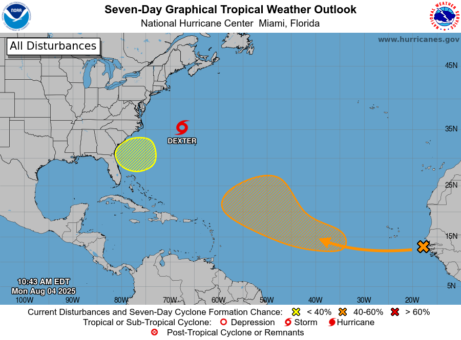
Other Areas of Interest
Central Tropical Atlantic: A tropical wave is forecast to move off the west coast of Africa today. Some gradual development of the wave is possible, and a tropical depression could form late this week while it moves generally west-northwestward across the central tropical Atlantic. The chance of formation is low (near 0%) through the next 48 hours and medium (40%) through the next 7 days.
Off the Southeastern United States: An area of low pressure could form in a couple of days a few hundred miles off the coast of the southeastern United States. Some gradual development of this system is possible during the middle or latter part of the week as the system drifts to the west or northwest. The chance of formation is low (near 0%) through the next 48 hours and low (20%) through the next 7 days.



