


An all new edition of the ABC 33/40 Weather Xtreme video is available in the player on the right sidebar of the blog. You can subscribe to the Weather Xtreme video on iTunes by clicking here.
WET AT TIMES: Generally speaking, the weather in Alabama doesn’t change too much during the summer months of June, July, and August, There is some risk of a shower or thunderstorm just about every day. The tricky part of the forecast is dealing with the coverage and placement of the daily batch of showers and storms. While we can’t tell you exactly when the rain starts and stops for any one given place, we are confidence we will have elevated coverage of showers and storms across our state this week.
Precipitable water values are high (greater than 1.7″ in most places), and the air aloft is colder since the upper ridge departed, making the air more unstable. We actually have a few widely scattered showers around at daybreak…
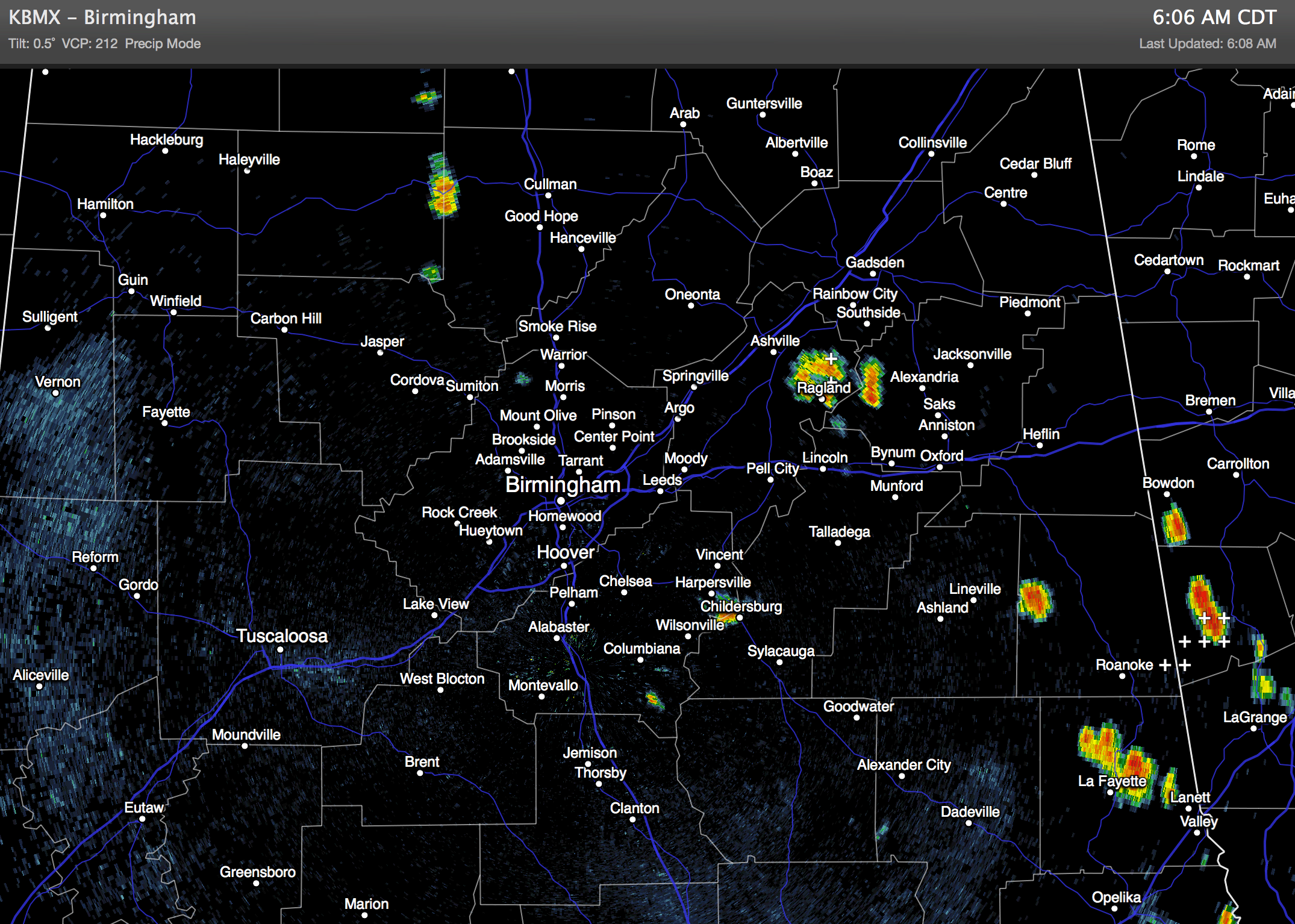
Showers and storms will become numerous at times later today and tonight; the heavier storms will produce lots of lightning, heavy rain, and gusty winds. A little small hail is possible as well, much like the storms we saw yesterday. We don’t expect to rise past the upper 80s today due to the clouds and showers.
REST OF THE WEEK: We don’t see much day to day change through mid-week… occasionally cloudy with scattered to numerous showers and storms. Highs in the mid to upper 80s. Best chance of rain will come during the afternoon and evening hours, but we can’t rule out a late night or morning shower as well.
FRIDAY AND THE WEEKEND: Models don’t agree well… but we do think we will see a slow decrease in the number of showers and storms, and we will roll with the typical late June forecast. Mixed sun and clouds each day with “scattered, mostly afternoon and evening showers and thunderstorms. Highs for the weekend 87 to 90 degrees.
AT THE BEACH: We project about 5 to 7 hours of sunshine each day this week from Panama City to Gulf Shores with the daily risk of scattered showers and thunderstorms. Showers will thin out along the coast for the upcoming weekend with increasing amounts of sunshine. Highs will remain in the upper 80s along the immediate coast, and the sea water temperature this morning at the Dauphin Island Sea Lab is 84 degrees.
TROPICS: All remains quiet, and tropical storm formation is not expected this week across the Atlantic basin.
WEATHER BRAINS: Don’t forget you can listen to our weekly 90 minute netcast anytime on the web, or on iTunes. This is the show all about weather featuring many familiar voices, including our meteorologists here at ABC 33/40. We will produce this week’s show at 8:30 CT tonight… you can watch it on “James Spann 24/7” on cable systems around the state, or on the web here.
CONNECT: You can find me on all of the major social networks…
Facebook
Twitter
Google Plus
Instagram
My friend and former co-worker, Birmingham TV legend Joe Langston, died over the weekend, and I will be attending the funeral this afternoon, so no afternoon Weather Xtreme video today. I will post a few forecast notes late in the day.



