


A complex set of storms in affecting areas west of I-65 tonight across Central Alabama.
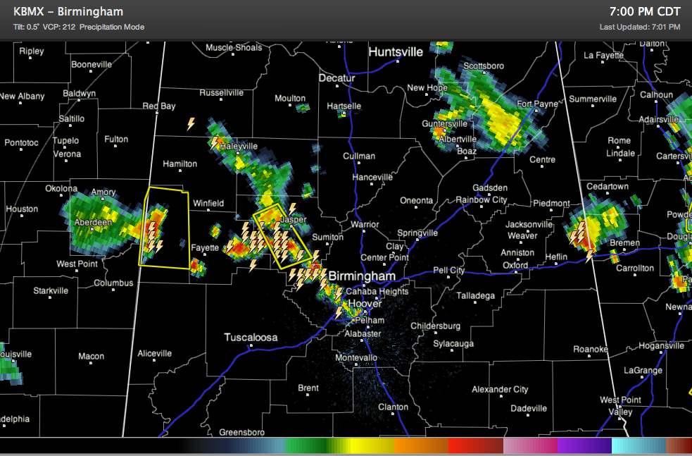
Storms are lined up across much of Walker County down into western Jefferson County. A severe thunderstorm warning remains in effect for Walker County. It has been canceled for Winston County since the storms have moved out of that area.
A severe thunderstorm warning is in effect for much of Lamar County for a storm coming out of Mississippi. Reports are that the sirens are going off there, but there is no tornado warning. Really there is almost no chance of a tornado, but damaging winds are a real threat.
We are getting reports of damage in Haleyville from strong storms a little earlier that resulted in a 60 mph wind report.
There are also storms on the eastern side of the state.
One especially intense one is over CLeburne County near Fruithurst. It will drop south southwest toward I-20 and affect folks driving from Talladega back on I-20 to the east towards Atlanta.
Other weakening storms are over Northeast Alabama, mainly over Marshall, DeKalb and Jackson Counties. The heaviest storm was near Guntersville.



