


Nearly every square inch of Alabama is under a slight risk for severe weather. Severe weather is expected to develop and spread across the state today. Ongoing showers and thunderstorms across the Tennessee Valley have been briefly severe this morning. Colbert and Franklin Counties earlier today were under a severe thunderstorm warning, but those have since been allowed to expire. Still more severe thunderstorms in Central Tennessee up closer to the low pressure with its enhanced dynamics.
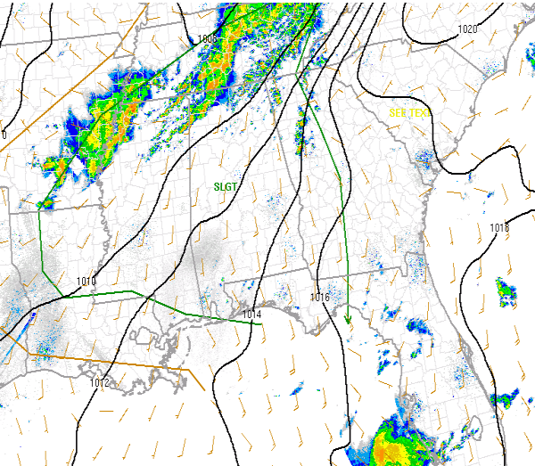
Across out part of the state our eyes are turned towards the activity along the Mississippi River. There is some convection along the River just south of Memphis and some of these cells have been severe at times. As the day progresses we will be watching for additional development along the cold front that will be moving in. Strong to severe storms will be possible once convective initiation begins. The threat for tornadoes remains low as the best dynamics are to our north, but there could be a few isolated ones this afternoon. Our main threat will be very large hail and damaging winds. Hail up to two inches in diameter may be possible across the Southeast.



