


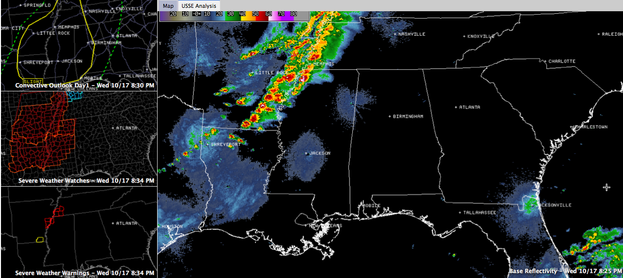
Click image to enlarge.
Thunderstorms literally exploded this afternoon across Arkansas and several of them are severe at this hour for several counties in western Tennessee, Arkansas and northwestern Mississippi.
A tornado crossed I-55 right now near Jehrico at 8:01. A tornado was reported to have touched down near the exit on I-55 there. This tornado is just northeast of Millington. Very strong signs of rotation in this area. There is an unconfirmed report of a 113 mph wind near the Memphis radar site near Millington.
A very dangerous storm prompting tornado warnings is about to cross I-55 south of Memphis near Senatobia.
Another tornado is about to cross the Mississippir River north of Helena AR at 8:30 p.m. Damage was reported earlier from this storm in Clarendon AR. Spotters reported a tornado in Clarendon and at 8:06 p.m. east of Clarendon. Damage has been reported in the town and the town is reportedly completely out of power. State Troopers were enroute.
The squall line is now lined up along the Mississippi River from western Kentucky through western Tennessee into eastern Arkansas. Instability is moderate and low level shear is strong over Arkansas, western Tennessee and northwestern Mississippi right now, causing the tornado threat.
The SPC has extended the slight risk severe weather forecast area eastward to include the Birmingham area.
Tornado watches cover much of Arkansas, western Tennessee and northwestern/Central Mississippi. They will likely be extended eastward into Alabama later.
The storms should congeal into more of a QLCS (quasi linear convective system) in the next couple of hours, with fewer discrete storms. This should reduce the major tornado threat in the next few hours. But there could still be tornadoes in the squall line as it pushes east. And there will be a significant damaging wind threat.
TIMING THE STORMS INTO ALABAMA:
The line of storms should reach Northwest Alabama’s Marion County before midnight, Pickens County around 1-2 a.m. It will progress eastward across Alabama during the early morning hours, reaching Jasper around 1 a.m. and Tuscaloosa around 2 a.m. They will reach Birmingham around 2:30-3 a.m. and eastern Alabama after that.
WILL THE STORMS WEAKEN?
The storms should gradually weaken as they push eastward, but they should stay severe over to near I-65. The tornado threat should weaken as they move further into Alabama, but with the squall line, there will be the threat of damaging winds and an isolated tornado over to a line from Decatur to Springville to Prattville. Isolated severe weather will still be possible into eastern Alabama. BUT, we have to be prepared in case the storms don’t weaken.
BE PREPARED OVERNIGHT
Have a reliable source to receive warnings, like a NOAA Weatheradio in alert mode, a smartphone app or a phone notifications system like WeatherCall. Think now about where you will go and what you will do if a tornado warning is issued for your location.



