


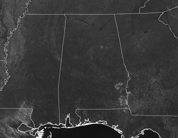
CONDITIONS AT 11:50 AM
It is an absolutely gorgeous day outside across Central Alabama as we make the approach to the noon hour. Almost completely clear skies out there with only a few spotty clouds over St. Clair and Talladega counties, and a few over Bullock and Barbour counties. Temperatures are already up in the 60s, with the warm spot being Tuscaloosa at 68º. Birmingham was at 64º, while Talladega was the cool spot at 62º.
NEAR SEVERE CLEAR FOR THE REST OF YOUR THURSDAY
We’ll continue to have near complete clear skies across Central Alabama throughout the remainder of the afternoon and into the early evening hours. Afternoon highs will be nice and mild, making it up into the upper 60s to the upper 70s across the area. The only thing you would have to worry about outdoors will be the pollen. For tonight and through the overnight hours, you will have no clouds to block your view of the stars in the night sky. Overnight lows will be in the 40s.
SOME CLOUDS, SOME SUN, STARTING TO WARM UP ON FRIDAY
We’ll have a mix of sun and clouds throughout the day on Friday, but it will be another dry and warm day across Central Alabama. Afternoon highs will get up into the mid to upper 70s for most locations across the area. A few more clouds will roll in during the evening and the overnight hours and there will be a very small chance of a brief shower or two over the extreme northwestern parts of the area. Overnight lows will be in the lower to mid-50s.

POTENTIAL FOR A FEW ISOLATED STRONG TO SEVERE STORMS ON SATURDAY
A cold front will be swinging through the area on Saturday which could bring to Central Alabama the potential for a few stronger to severe storms during the afternoon and evening hours. At this point, this looks to be another damaging wind and large hail event as the moisture return out ahead of the front is lacking, keeping the threat of tornadoes out of the forecast. SPC has locations in the extreme northwest and western parts of the area defined in a Marginal Risk for severe storms. Timing looks to be from 1:00 pm to 9:00 pm at this point. We’ll have to keep our eyes on this system… if there is more moisture available ahead of the front, then tornadoes would become a threat.
BEACH FORECAST CENTER
Get the latest weather and rip current forecasts for the beaches from Fort Morgan to Panama City on our Beach Forecast Center page. There, you can select the forecast of the region that you are interested in.
IT’S THAT TIME AGAIN FOR INDYCAR AT BARBER
The Honda Indy Grand Prix of Alabama will be April 5-7 at the beautiful Barber Motorsports Park! Make plans for the event that has been voted “Best Annual Event” & “Best Sporting Event” in Birmingham. Kids 15 & under are admitted free with a ticketed adult, and three-day general admission tickets are $69. Single day tickets are as low as $15. Pack a picnic/cooler and bring the family out for a weekend full of activities and racing! For tickets, CLICK HERE.
ALREADY OFF TO A HOT START IN 2019! ADVERTISE WITH THE BLOG!
We have enjoyed over 5.7 MILLION page views on AlabamaWx.com so far in 2019! Don’t miss out! We can customize a creative, flexible and affordable package that will suit your organization’s needs. Contact Bill Murray at (205) 687-0782.
E-FORECAST
Get the Alabama Wx Weather Blog’s Seven-Day Forecast delivered directly to your inbox by email twice daily. It is the most detailed weather forecast available in Central Alabama. Subscribe here… It’s free!
CONNECT WITH THE BLOG ON SOCIAL MEDIA
You can find the AlabamaWx Weather Blog on the major social media networks:
Facebook
Twitter
Instagram
WEATHERBRAINS
Don’t forget you can listen to our weekly 90 minute netcast anytime on the web at WeatherBrains.com or on iTunes, Stitcher, or Spotify. This is the show all about weather featuring many familiar voices, including the meteorologists at ABC 33/40.



