


Dewpoints are increasing across Central Alabama this afternoon as moisture lifts northward with a warm front. Skies are mostly cloudy along and south of I-20 with partly cloudy skies to the north.
Temperatures are in the 70s over the state, except for a few low 80s over South Alabama.
Instabilities are on the rise, with CAPE values exceeding 1,500 joules/kg over the southern two-thirds of the state.
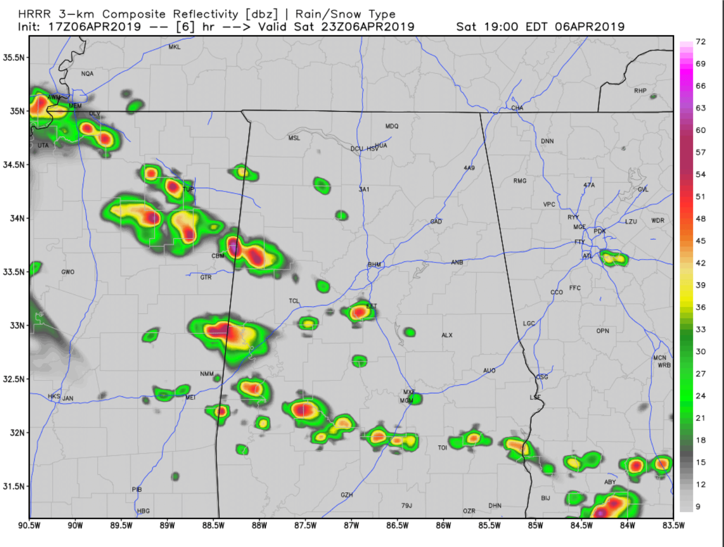
Storms will develop along and behind the warm front as it lifts northward. There is no much wind shear today, more like a summer day, so storms will be of the pulse variety, and won’t become organized. But with a good supply of dry air aloft, the stronger ones may produce strong wind gusts. There is a chance a couple of them could become severe. Hail will also be a threat.
Here is the HRRR depiction for 6 p.m.
Widespread thunderstorms are across Texas, Arkansas, and Louisiana this afternoon. They are associated with a strong upper-level trough that will be sliding northeast over the next 24 hours. A tornado watch covers much of eastern and central Texas at this hour. These storms will form into a mesoscale convective system that will track across Mississippi and into western Alabama late this evening. The storms will have the potential for damaging winds and large hail as they move into our state.
They will push eastward during the late evening and early morning hours, remaining generally north of I-20, but could affect areas as far south as a line from Eutaw to Clanton to Alex City.



