


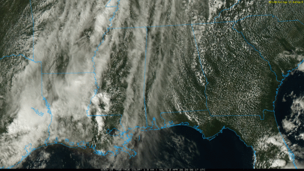
RADAR CHECK: Showers are almost impossible to find across Alabama this afternoon… with a partly sunny sky most communities are in the low to mid 80s. The sky becomes mostly cloudy late tonight with a low in the 60s.
Alabama’s weather won’t change much tomorrow and Saturday with partly sunny, warm days and a few isolated afternoon and evening showers and thunderstorms. The chance of any one spot getting wet each day is 15-25 percent, and highs will be in the low to mid 80s.
EASTER FRONT: A cold front will bring an organized band of rain and thunderstorms into Alabama over the weekend. The rain is most likely for the northern half of the state from around midnight Saturday night to 10:00 a.m. Sunday… and for South Alabama from 10:00 a.m. until 6:00 p.m. Sunday. Rain amounts for most places will be in the 1/2 to 1 inch range.
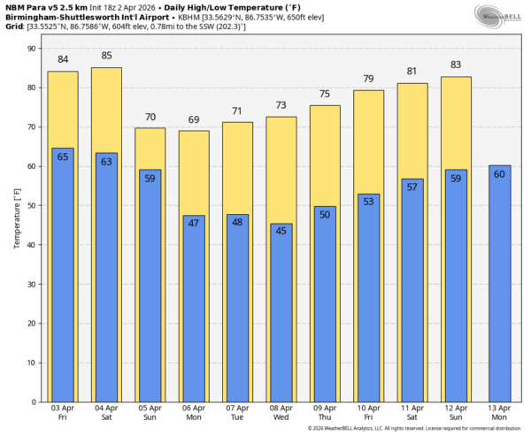
While a strong storm is certainly possible, the overall severe threat looks low as the main dynamic support will be well to the north, and instability values won’t be especially high. After highs in the 80s Sunday, many North Alabama communities won’t get out of 60s Sunday as we experience an airmass change.
NEXT WEEK: For now the week looks dry with sunny pleasant days and clear cool nights. Highs mostly in the 70s, lows in the 40s and 50s. Still no sign of any late season frost/freeze event for Alabama through the week… See the video briefing for maps, graphics, and more details.
ON THIS DATE IN 1970: An EF2 tornado moved through Glencoe and Hokes Bluff in Etowah County. A service station and mobile home were demolished, several homes were unroofed, and several mobile homes were damaged near Glencoe. Several buildings were damaged in Hokes Bluff.
ON THIS DATE IN 1982: Severe thunderstorms touched off 56 tornadoes in the central U.S. An F5 multiple vortex tornado traveled 53 miles from Speer to Broken Bow in southeast Oklahoma. It was the first U.S. F5 tornado after a five year drought.
Look for the next video briefing here by 6:00 a.m. tomorrow…



