


An all new edition of the ABC 33/40 Weather Xtreme video is available in the player on the right sidebar of the blog. You can subscribe to the Weather Xtreme video on iTunes by clicking here.
COMPLEX FORECAST: This is clearly a forecast that is a roller coaster ride for Alabama in the days ahead. Looking at a simple forecast with a little picture of a sun or cloud with one number high/low just won’t help much. There will be days with a 40 degree temperature swing across Alabama, and also days with some potential for strong storms, heavy rain, and even a little ice up over Northwest Alabama. Much to discuss.
TODAY/TOMORROW: We warm up; look for a high in the mid to upper 60s today, followed by low to mid 70s tomorrow. The air will be moist, and the sky will be generally cloudy. While a few showers are possible, they should be pretty widely spaced, and a decent part of these two days will be dry.
TO THE NORTHWEST: We will watch bitterly cold air flooding the western half of the nation. The leading edge of the Arctic air has arrived in Montana; Cut Bank is reporting 3 degrees at this hour (6a CT) with a wind chill index of -21 and snow. Some cities in Montana and North Dakota will experience a low in the -20 to -30 degree range by Wednesday and Thursday morning.
STRONG STORMS THURSDAY: The NAM is printing a high of 78 degrees for Birmingham Thursday; that is within one degree of the record high for December 5, 79 set in 1998. The air becomes unstable with surface based CAPE values exceeding 1200 j/kg here…
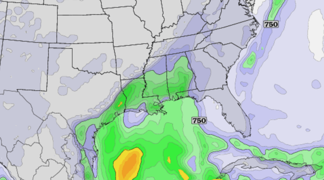
SPC does not have a formal severe weather risk in place, but they do have the low end 5 percent chance over parts of Alabama. Vertical velocities are marginal for severe weather, but we will watch things closely as we get closer to Thursday. Showers and storms are likely during the day statewide.
COLD AIR CREEPS IN HERE FRIDAY: Temperatures will be all over the board Friday as a shallow layer of Arctic air begins to move into the state. At daybreak, I expect places like Muscle Shoals and Florence to be in the 30s, while Birmingham, Tuscaloosa, Anniston, and Gadsden are in the 60s. Temperatures in these four cities should begin to fall during the day, and we should be in the 40s by mid to late afternoon with a chilly north wind. And, clouds hang tough and more rain is likely during the day Friday as the cold air moves in, and an unsettled southwest flow aloft continues.
ICY MESS TO THE WEST: Freezing rain and ice accumulation will be an issue Friday in the cold air for cities like Memphis, Little Rock, and Dallas/Fort Worth. If you are traveling west on Friday, be aware of the potential of a high impact winter weather event in these places along with travel problems due to the ice.
FRIDAY NIGHT/SATURDAY: This is a window for some freezing rain/icing issues over the northwest corner of Alabama, especially in Lauderdale and Colbert Counties. Temperatures will drop down in the 28-32 degree range with some rain likely. There might even be a touch of icing as far south as Hackleburg and Hamilton, but odds are higher toward Florence.
COLD, WET BEGINNING TO THE WEEKEND: Saturday looks like a cold, wet day. Clouds, rain at times, and temperatures holding in the 40s over North/Central Alabama.
SUNDAY: Another day with temperatures all over the board. Cold air remains over Northwest Alabama, we have a “wedge” of cold air to the east over Georgia associated with cold air damming (CAD), and some of this could creep into East Alabama. And, to the south, a warm front will be moving north, pushing temperatures in the 60s and 70s over Central and South Alabama.
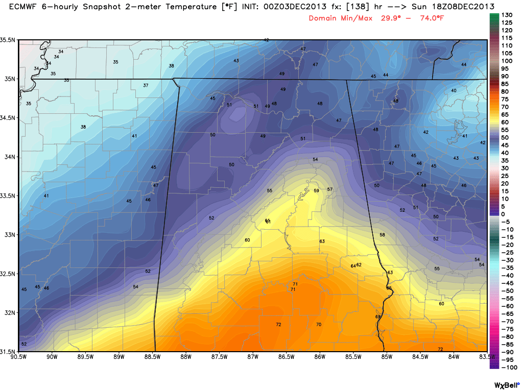
And, occasional showers are likely, with rain potentially becoming heavier and widespread late in the day into Sunday night. For now we are not expecting any icing issues Sunday night, if anything we will have to worry about heavy rain and some flooding.
NEXT WEEK: Rain moves out Monday, but another soaking rain event looks like Wednesday with yet another wave coming out of the Southwest U.S.
Take some time to watch the Weather Xtreme video for the maps, graphics, and more details on this very complex weather pattern.
WEATHER BRAINS: Don’t forget you can listen to our weekly 90 minute netcast anytime on the web, or on iTunes. This is the show all about weather featuring many familiar voices, including our meteorologists here at ABC 33/40. Was great having Roger Edwards on the show last night; scroll down for the show notes and details.
CONNECT: You can find me on all of the major social networks…
Facebook
Twitter
Google Plus
Instagram
I will be doing a weather program today at Southside Elementary School in Etowah County… look for the next Weather Xtreme video here by 4:00 or so this afternoon. Enjoy the day!



