Daily Weather Briefing
Sunday, November 15, 2026
ALABAMA THIS MORNING
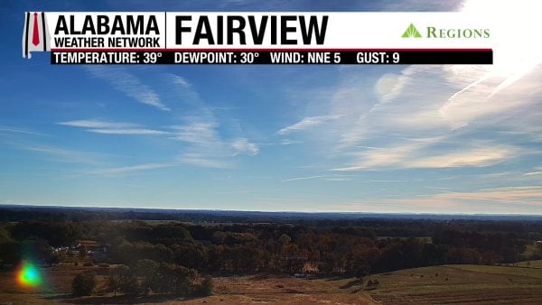
It’s another cold morning across the state with temperatures in the upper 30s to low 30s over north and north-central Alabama, the low to mid 30s in south-central Alabama, and the mid 30s to low 40s in the south and on the coast. A Freeze Warning across most of the state expired at 8 a.m., just as a Frost Advisory did for the south. Skies are mostly clear with some high cirrus clouds like the ones visible on the Fairview Regions Skycam.
ALABAMA 7 DAY FORECAST
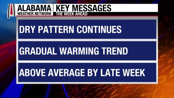
Surface high pressure to our north and a building upper-level ridge will keep Alabama dry this week. We’ll see temperatures slowly increase each day, and there is a low chance for a shower or two on the coast during the early part of the work week.
ANOTHER COLD DAY TODAY – Nov 15
After another chilly morning, Alabama will see temperatures warm to the upper 50s to low 60s statewide by the afternoon. Skies will be partly to mostly cloudy, with the heavier cloud cover expected south.
LITTLE CHANGE MONDAY, LOW RAIN CHANCE – Nov 16
Monday morning’s lows may warrant another mix of frost/freeze warnings across the northern half of the state as they are expected to reach the low 30s north, mid 30s centrally, and mid 30s to low 40s in the south. Highs will be in the upper 50s to low 60s across the state, with the low 60s favoring central Alabama. A 10% chance of showers exists for the coast throughout the day.
WARMING TREND THROUGH END OF WEEK – Nov 17-19
Tuesday through Thursday will see temperatures increase each day and stay rain-free.
Tuesday morning will start off with temperatures in the upper 20s to low 30s north, low to mid 30s centrally, and mid 30s to low 40s south. Coastal Alabama will sit in the mid 40s. Highs will rise into the low to mid 60s in the north, and the mid to upper 60s over the southern two-thirds of the state.
Lows on Wednesday will range from the mid to upper 30s north, upper 30s to low 40s in central Alabama, and low to mid 40s south. The coast will fall to the low 50s. By afternoon, highs will be in the upper 60s to low 70s across Alabama.
Thursday morning’s lows will range from the mid 30s north to the upper 40s to low 50s south. Highs will stretch from the low 70s north to mid 70s south.
DRY CONDITIONS TO END THE WEEK AND PUSH INTO WEEKEND – Nov 20-21
Dry conditions, cold mornings, and pleasant afternoons are expected Friday and Saturday.
Friday will see lows fall to the upper 30s to low 40s north to low 50s south, then highs will reach the low to mid 70s statewide.
The low 40s to upper 40s are expected in the north and south, respectively, on Saturday morning. Highs will be similar to Friday’s.
RAINFALL OUTLOOK
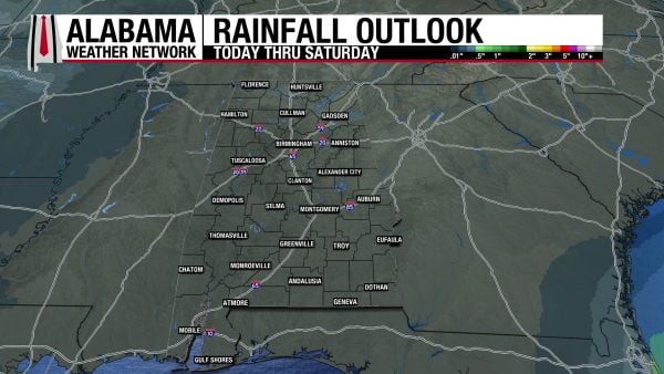
The forecast is trending drier each day, with Monday’s coastal rainfall so limited that no meaningful rainfall total is expected there this week.
TROPICAL UPDATE
Neither the Atlantic nor the Pacific basins are expected to have any tropical activity over the next seven days. Both basins’ hurricane seasons end on November 30th.
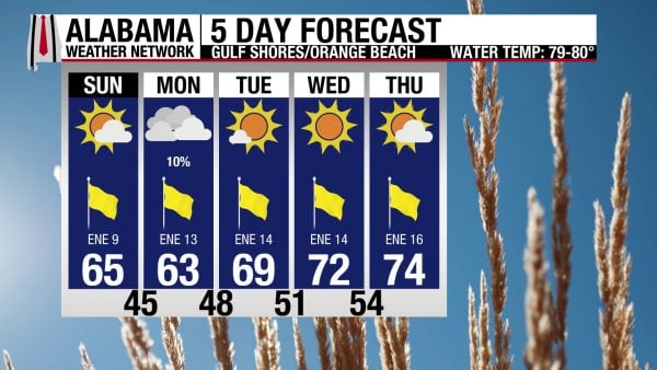
GOOD BEACH CONDITIONS
The weather at the beach will be pleasant, although cool through Tuesday. Today, the high will be in the mid 60s, skies will be mostly sunny with a Moderate UV Index, and winds will blow from the northeast at 10 to 15 mph. Tomorrow features a low, 10% chance of a shower or two, then a warming trend begins Tuesday and persists through Thursday.

WEATHERBRAINS 1087
Tomorrow’s WeatherBrains episode brings in Matt Dixon and Eric Hunt to talk about the roles of an agricultural meteorologist. Then Ben Noll will break down El Niño and its influence on our winter. Listen to the episode wherever you get your podcasts, or watch it here!
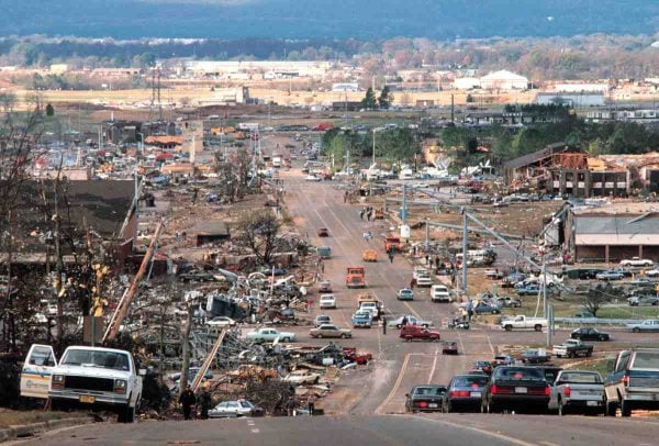
TODAY IN WEATHER HISTORY
November 15, 1989 – The Huntsville Tornado
On the afternoon of November 15, 1989, one of the deadliest and most destructive tornadoes in Alabama history tore through Huntsville, forever changing the city and the lives of thousands of its residents. It was a Wednesday afternoon, and a powerful storm system was moving across the Tennessee Valley, drawing warm, moist air northward from the Gulf of Mexico ahead of an advancing cold front. Temperatures had climbed into the 70s, and the atmosphere had become increasingly unstable as strong winds at different elevations created conditions favorable for rotating thunderstorms. A tornado watch had been issued at 12:30 p.m., and severe thunderstorms were already producing hail and damaging winds across northern Alabama. Yet few could have imagined the catastrophe that was about to unfold. Around 4:30 p.m., as thousands of people were leaving work, picking up children, and navigating the city’s busy streets, a violent F4 tornado touched down on Redstone Arsenal near Madkin Mountain. Within minutes, it would become one of the most devastating urban tornadoes the state had ever experienced.
The tornado initially caused relatively minor damage as it moved northeastward across Redstone Arsenal, but it intensified dramatically as it approached the densely developed commercial district along Airport Road. The most catastrophic destruction occurred near the intersection of Airport Road and Memorial Parkway, one of Huntsville’s busiest intersections. Shopping centers, office buildings, restaurants, and apartment complexes were ripped apart as the enormous circulation crossed the highway and continued toward Whitesburg Drive. The tornado’s damage path averaged approximately half a mile wide, and the winds were powerful enough to sweep vehicles from roadways, overturn automobiles, and reduce substantial buildings to rubble. Waterford Square Apartments suffered devastating damage, while businesses along Airport Road were virtually erased. The timing made the disaster particularly deadly. Traffic was heavy, visibility was extremely poor, and motorists had little opportunity to recognize the approaching tornado or escape its path. Twelve of the 21 people who ultimately died were in automobiles, a tragic illustration of the vulnerability of motorists caught in violent tornadoes. Nineteen fatalities occurred within the short stretch between Memorial Parkway and Whitesburg Drive, where the tornado struck the heart of the city’s afternoon traffic.
After crossing Whitesburg Drive, the tornado climbed Garth Mountain and descended into the residential neighborhoods of Jones Valley, where another terrifying scene unfolded. At Jones Valley Elementary School, 37 children attending an after-school care program were still inside the building, along with five teachers and seven painters. As the storm approached, the supervising teacher moved the children from the second floor into a small protected area beneath a stairway on the first floor, following guidance that the school principal had provided earlier. Moments later, the tornado struck the school with tremendous force, destroying much of the second story and severely damaging the building. Remarkably, every child and adult sheltering inside survived. The teacher’s quick action became one of the most extraordinary survival stories of the disaster. Beyond the school, the tornado ripped through the Jones Valley subdivision, destroying or heavily damaging well-built homes before continuing over Huntsville Mountain into the more rural eastern sections of Madison County. It crossed U.S. Highway 431, moved through the Dug Hill area, and eventually crossed the Flint River and U.S. Highway 72 near Brownsboro before dissipating near Killingsworth Cove. By the time it lifted, the tornado had traveled 18.5 miles, and its damage path had widened to nearly a mile in some locations.
The scale of the destruction was staggering. Twenty-one people lost their lives, and another 463 were injured, overwhelming emergency medical services and hospitals across the Tennessee Valley. Initial damage estimates approached $100 million, although later assessments placed total losses closer to $250 million. At least 259 homes were destroyed, another 130 sustained major damage, and 148 suffered lesser damage. Eighty businesses were destroyed, three churches were heavily damaged, and two schools were demolished. More than 1,000 automobiles were damaged or destroyed, and entire sections of Airport Road resembled a war zone. Emergency workers, police officers, firefighters, medical personnel, and volunteers converged on the devastated neighborhoods, searching collapsed buildings and damaged vehicles for survivors. The disaster also exposed important limitations in the weather warning technology available at the time. Although a tornado watch had been issued hours earlier and a severe thunderstorm warning was in effect for Madison County, the local weather radar did not clearly identify the developing tornado. A specific tornado warning was not issued before touchdown. The National Weather Service had issued a severe thunderstorm warning at 4:13 p.m., providing approximately 17 minutes of notice that dangerous weather was approaching, but the violence of the tornado exceeded what many residents anticipated. The catastrophe would become an important case study in tornado detection, warning communication, and the vulnerability of densely populated communities during afternoon rush hour.
In the days and weeks that followed, Huntsville began the difficult process of recovering from one of the darkest afternoons in its history. Families buried loved ones, injured residents faced lengthy recoveries, and hundreds of households were left without homes. Along Airport Road, the rebuilding process gradually transformed the landscape, but memories of the destruction remained vivid for those who had witnessed it. The disaster helped reinforce the importance of improved Doppler radar technology, reliable warning dissemination, and public education about tornado safety. More than three decades later, the Huntsville tornado remains one of Alabama’s most significant weather disasters, remembered for its extraordinary violence, its tragic human toll, and the resilience of a community that rebuilt in its aftermath. For those who lived through that Wednesday afternoon, the memories of the darkening sky, the terrifying roar, and the destruction along Airport Road have never faded.
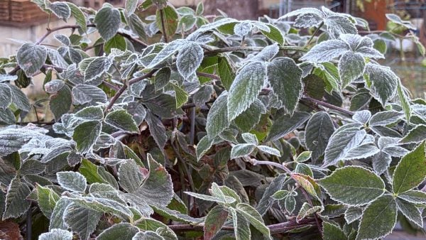
IMAGE OF THE DAY
Skywatcher Daniel Harbin sent in a few photos of some fruit and vegetable crops covered in frost this morning!