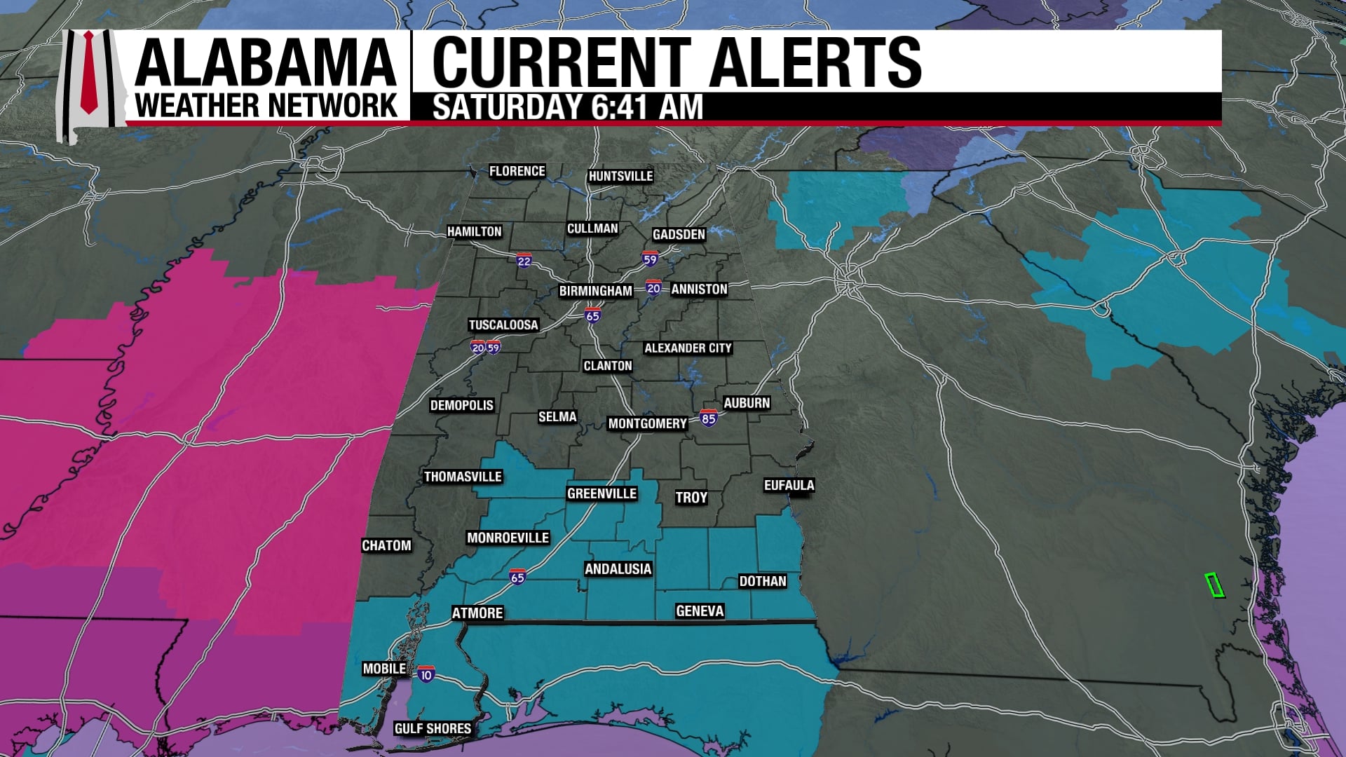
WARMER DAYS AHEAD: Most Alabama communities are in the 28-35 degree range early this morning just before daybreak. Look for a partly sunny sky today with a high in the 60s this afternoon as a warming trend begins. A disturbance could bring a few sprinkles to the Tennessee Valley today, but most all of Alabama will remain rain-free.
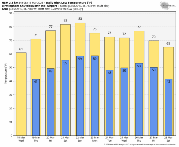
Dry weather continues through the weekend with warmer afternoons. By Saturday and Sunday afternoon highs will be in the low to mid 80s.
NEXT WEEK: For now it looks like the dry weather pattern will stay in place; highs drop back in the 70s with lows generally in the 50s. The chance of meaningful rain across Alabama for the next 10 days looks very low… See the video briefing for maps, graphics, and more details.
ON THIS DATE IN 1925: In the midday and afternoon hours of Wednesday, March 18, 1925, the deadliest tornado in United States history and second-deadliest worldwide moved through Eastern Missouri, Southern Illinois and Southern Indiana, killing 695 people and injuring 2,027 more in what is known as the Tri-State tornado. The tornado touched down as part of a larger severe weather outbreak, and produced catastrophic damage across numerous communities across all three states. Despite not being officially rated, it is widely accepted to have been equivalent to an F5 on the Fujita scale.
There has long been uncertainty as to whether the originally recognized reports of a 219 mile path over 3.5 hours represent a single continuous tornado or multiple independent tornadoes belonging to a tornado family. Because of the scarcity of verifiable meteorological data from the time of the event and the apparent absence of any record of a tornado having approached this path length and duration in the years since, doubts have been raised about the plausibility of the conclusion that a single tornado was responsible for them.
ON THIS DATE IN 2013: An intense, long lasting line of thunderstorms, known as a derecho, moved through central Alabama during the afternoon and evening hours. As the line entered the state from Mississippi, it brought with it damaging straight line winds of widespread reports of 60 to 80 mph, including a measured report of 88 mph. These winds resulted in trees and power lines down across the northern two-thirds of Alabama. Along with the wind from the derecho, up to two inch hail was reported and eventually an EF-1 tornado spun up in northern Etowah County at Sardis City.
Look for the next video briefing here by 3:00 this afternoon… enjoy the day!