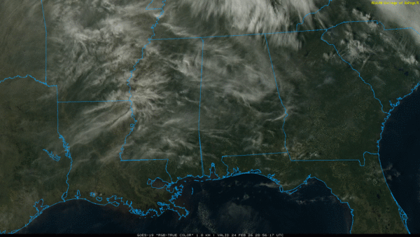
WARMER: As advertised, temperatures are in the 50s across Alabama this afternoon with sunshine through high cirrus clouds. Most communities will stay above freezing tonight; expect a low in the 34-44 degree range.
Tomorrow will be another mostly dry day with a high in the 60s. We should mention a few isolated could form near the Alabama/Tennessee state line during the afternoon and evening hours.
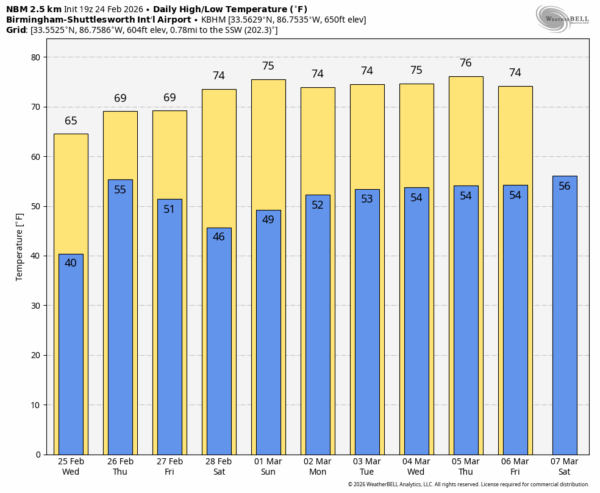
THURSDAY: An approaching surface front will bring showers into Alabama Thursday and Thursday night. While some thunder is possible, we don’t severe storms due to limited instability and weak dynamics. Rain amounts will be in the 1/2 to one inch range for most of the state, and afternoon temperatures will rise into the 67-74 degree range.
A few lingering showers are possible Friday over the southern half of Alabama, but the northern counties should be dry. And, the weather stays mild with highs in the upper 60s and low 70s.
THE ALABAMA WEEKEND: Most of the state will be dry with a good supply of sunshine both days. The weather stays mild with highs generally in the 70s.
And, for now, much of next week looks mild and dry with highs holding in the 70s as we get into the month of March. A few showers could show up over the northern part of the state late in the week… see the video briefing for maps, graphics, and more details.
ON THIS DATE IN 1961: A destructive outbreak of 14 tornadoes hit the Southeast, including a strong F2 tornado in Alabama that moved through Hurtsboro, Hatchechubbee, Seale and Flournoys, obliterating homes, blowing down trees, and injuring four.
ON THIS DATE IN 2001: Over a dozen tornadoes spawned in central and eastern Arkansas. The strongest tornado (F3) was in Desha County, with parts of a farm shop found six miles away from where it was blown apart. An 18-month-old was killed in Fulton County by an F2 tornado.
Look for the next video briefing here by 6:00 a.m. tomorrow…