


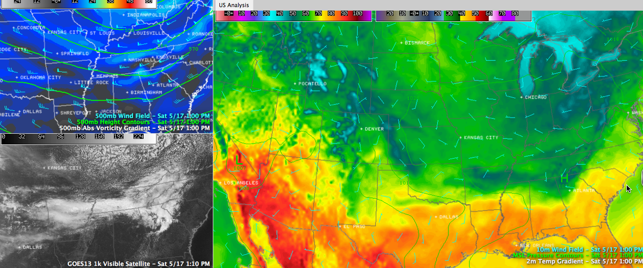
An impressive upper trough extending from an upper low over eastern Canada down into the Tennessee Valley is lifting slowly northeastward on this mid-May Saturday. The trough has made quite a name for itself this week, and its thumbprint is still evident in temperatures maps across the Lower 48.
Click image to enlarge
In fact, you hardly need an upper air chart to pick out the location of the trough at lunchtime. 70s, 80s and 90s, which would be commonplace on a May map are suppressed way to the south across the southern tier of states from California to the Carolinas. There was quite a contrast across Alabama at noon as well, with readings across the great state of Alabama ranging from 52F at Fort Payne to 81F at Andalusia.
After a mostly cloudy start over the northern half of the area, skies were mainly clear by lunchtime south of a line from Florence to Cullman to Jacksonville. The exception was some evaporating clouds along I-20 from Birmingham to Heflin.
MORNING RAINFALL: Rainfall amounts this morning were light, as predicted. The Birmingham Airport picked up 0.14”, the Shelby County Airport only measured 0.01” and Tuscaloosa only a trace. The best amounts fell across parts of Marion, Winston, Cullman, Blount and northern Etowah counties, but even there, amounts were probably only around one quarter of an inch. Haleyville did measure 0.17″.
TEMPERATURES TODAY: That wide range in temperatures will continue all afternoon, with readings in the far northeastern part of the state will only be in the 60s, with 80s in the US-80 Corridor and 70s in between. Lows tonight will be generally in the 50s, with a few 40s in the colder valleys of Northeast and East Alabama.



