


The Central Alabama Weekend
Ridging stays in control of our weather pattern throughout the weekend and through the work week ahead, so not much change is expected with the day-to-day forecast. Saturday will feature plenty of sunshine to start but some clouds will build with the heating of the day. A few isolated afternoon showers and thunderstorms can be expected but overall chances remain low. Highs across Central Alabama will be in the lower to mid-90s and humidity levels should remain low enough that we’ll stay below heat advisory criteria.
Same story for Sunday… A good bit of sunshine early with skies becoming partly cloudy by afternoon. Isolated afternoon showers and thunderstorms are possible with chances remaining low at this point. Highs will be in the mid to upper 90s.
The Work Week Ahead
Moisture levels increase across much of the area on Monday which will allow for a little higher coverage in afternoon showers and storms, but the overall forecast will continue to be hot and humid with a small chance of isolated to scattered afternoon and early evening showers and thunderstorms. Highs will be in the mid-90s for most.
A small difference on Tuesday’s forecast as high temperatures will be a touch lower, but the rest remains the same… hot, humid, chance of scattered afternoon and early evening showers and thunderstorms. Highs will be in the lower to mid-90s.
Wednesday through Friday looks pretty similar as well… Each day will be hot and humid with the chance of scattered mainly afternoon and early evening showers and thunderstorms. Highs will be in the lower to mid-90s on each day.
Voodoo Land Look At The Temperature Outlook
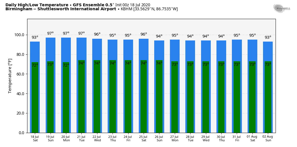
From now through the end of the month, the GFS Ensemble shows temperatures remaining in the mid-90s on each day with lows staying similar in the lower to mid-70s.
A Quick Peek At The Tropics
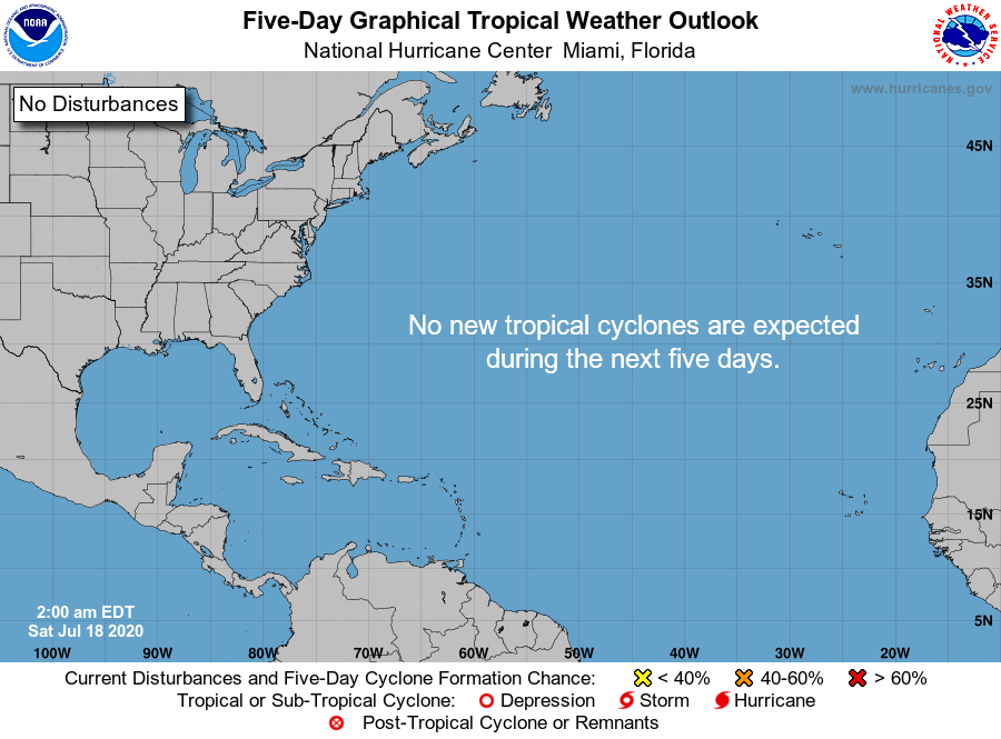
Tropical cyclone formation is not expected during the next 5 days across the Atlantic Ocean, the Caribbean Sea, and the Gulf of Mexico.
On This Date in Weather History
1986 – One of the most photogenic tornadoes touched down in the northern suburbs of Minneapolis, MN, during the late afternoon. The very slow-moving tornado actually appeared live on the evening news by way of an aerial video taken by the KARE-TV helicopter crew. The tornado, unlike most, was quite the prima donna, staying visible to tens of thousands of persons for thirty minutes. It was moderate in intensity, with winds of 113-157 mph, and caused 650 thousand dollars damage.
Beach Forecast Center
Get the latest weather and rip current forecasts for the beaches from Bay St. Louis, MS, to Panama City Beach, FL, on our Beach Forecast Center page. There, you can select the forecast of the region that you are interested in.
Advertise On The Blog!
We had another fantastic year in 2019 with just over 17 million page views! That brings our total for the last 2 years close to 37 million page views! Don’t miss out! We can customize a creative, flexible, and affordable package that will suit your organization’s needs. Contact Bill Murray at (205) 687-0782.
E-Forecast
Get the Alabama Wx Weather Blog’s Seven-Day Forecast delivered directly to your inbox by email twice daily. It is the most detailed weather forecast available in Central Alabama. Subscribe here… It’s free!
Connect With The Blog On Social Media
You can find the AlabamaWx Weather Blog on the major social media networks:
Facebook
Twitter
Instagram
WeatherBrains
There are several ways to watch or listen to the podcast that is all about the weather. Watch live starting at 8:00 pm CT on Monday nights at live.bigbrainsmedia.com, James Spann’s Youtube Channel, or on one of ABC 3340’s digital weather channels (17.2, 40.2, 68.3). Listen to the recorded audio podcast at WeatherBrains.com or on your favorite podcast platform (Apple Podcasts, Stitcher, Spotify, etc.), or watch the recorded video on James Spann’s Youtube channel.



