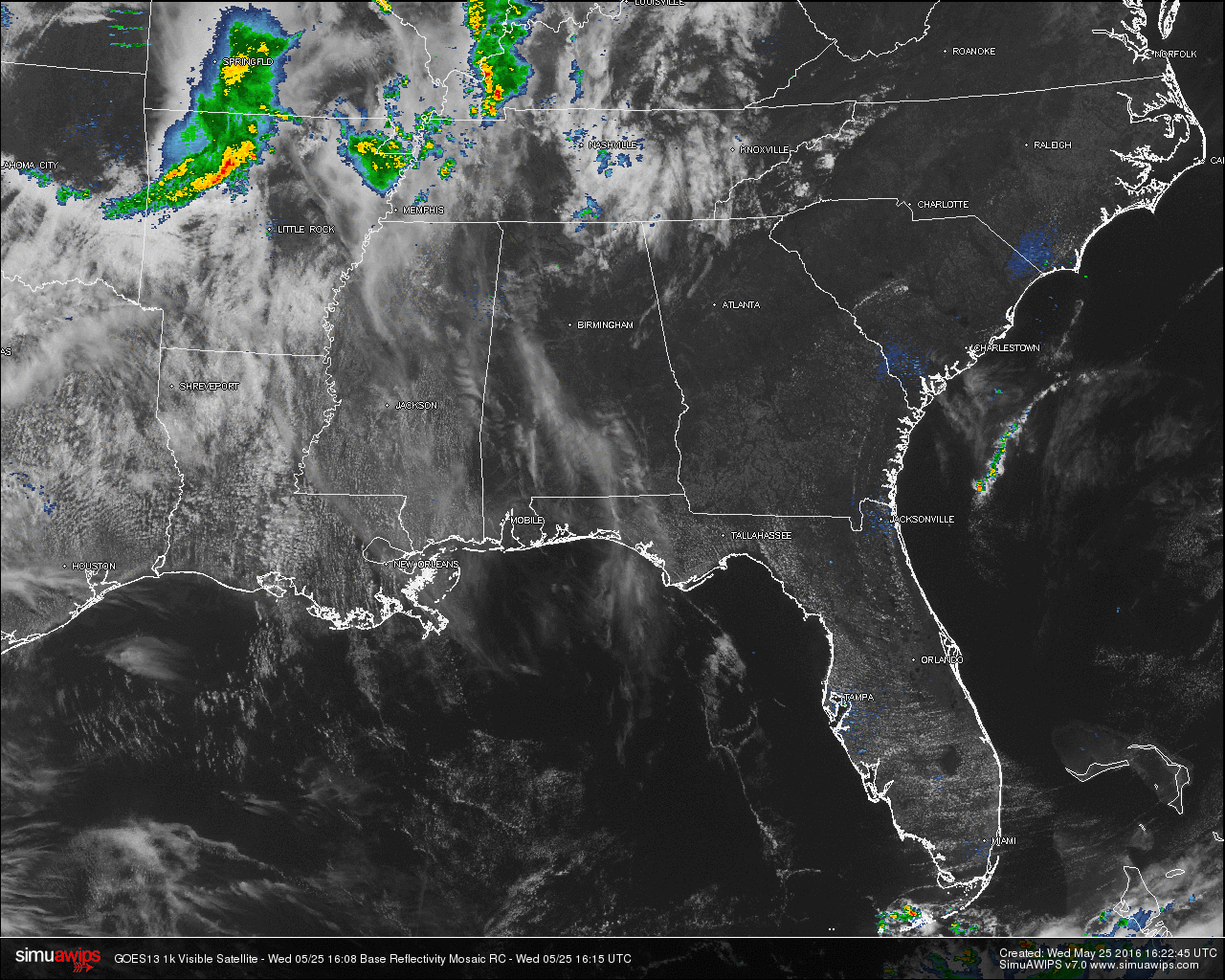
Most of Central Alabama at this hour is under mostly clear skies, but a few sections in the area have some clouds. Good news with the clouds that are currently over parts of the area, there is no rain involved with these. We note back to our northwest over Northwestern and Northeastern parts of Arkansas that a line of storms is moving southeastward. No warnings are associated with these at this time, but there is a possibility that the southern end of this feature could clip parts of North Alabama later today.
QUICK LOOK AT TEMPERATURES: A mix of 70s and 80s are being reported across Central Alabama at this time. The warm spot in the state being Montgomery at 83. Here is a list of temperature readings from across the state at this time:
Birmingham 81
Tuscaloosa 79
Muscle Shoals 82
Huntsville 79
Anniston 78
Alexander City 78
Montgomery 83
Dothan 80
Mobile 79
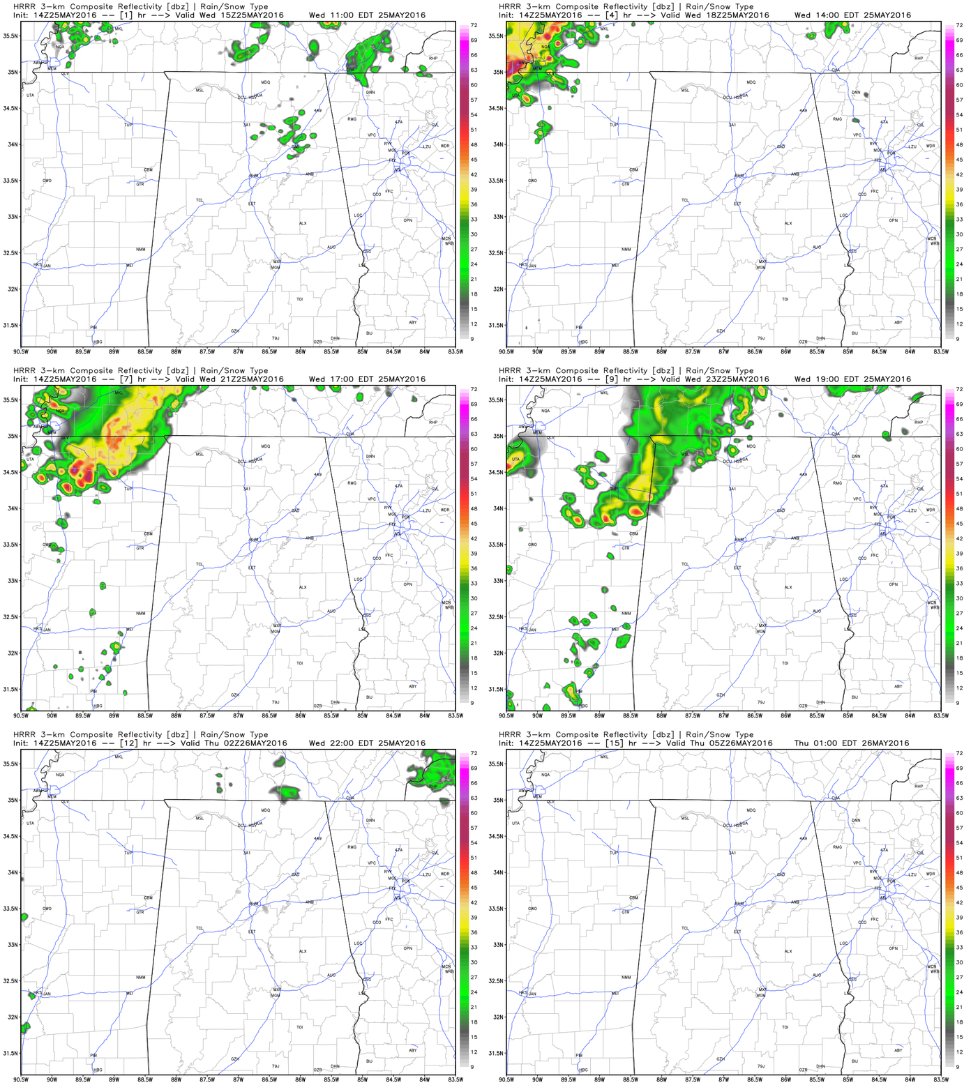
HRRR Model Run valid until midnight tonight.
REST OF TODAY: Skies should remain mostly clear for most of the area, but some clouds will build during the afternoon hours. According to the latest HRRR model run, there is a chance that the southern end of a MCS that will be moving through Tennessee this afternoon could move through the northwestern counties of the state from the 4PM to 8PM time frame, but totally dissipates by the time it reaches the I-65 corridor. We’ll note that the NAM4k is not even showing it. I’ll mention a small risk of showers and storms for those counties. There is no severe threat with these, and there is no risk outlined by the SPC. Other than that, the rest of Central Alabama will remain dry. Afternoon highs will reach the upper 80s to right at 90. Some places might actually reach 91 or 92 today.
AIR QUALITY ALERT FOR BIRMINGHAM AREA: Today’s Air Quality Index will be in the CODE YELLOW (moderate) for ozone and particulate matter. Unusually sensitive people should consider limiting prolonged outdoor exertion.
CLIMATOLOGY FOR BIRMINGHAM: The normal high temperature for May 25th in Birmingham is 83, while the normal low is 60. The record high of 95 was reached in 1962. The record low of 45 was set back in 1979.
THURSDAY: Mostly sunny skies tomorrow, and the dewpoints and humidity levels are on the rise. Afternoon highs for most communities will be at close to 90 degrees.
HEADED TO THE BEACH: Mostly sunny days, fair nights through Memorial Day from Gulf Shores east to Panama City Beach. Highs on the immediate coast will be in the low 80s, with upper 80s inland. See a very detailed beach forecast here.
TROPICAL MISCHIEF?: Hurricane season in the Atlantic basin officially begins one week from today (also the beginning of meteorological summer), but we are watching a disturbance east of the Bahamas. There is a chance this could become a hybrid type tropical low in coming days as it drifts toward the South Atlantic coast of the U.S. If this happens to develop, it should have no direct impact on Alabama or the Gulf Coast.
SEC BASEBALL TOURNAMENT: It continues through Sunday at the Hoover Metropolitan Stadium; the weather looks fantastic with mostly sunny days and fair nights. We will mention a small risk of an afternoon shower or storm Saturday and Sunday, but rain should pose no big issue. The weather will heat up with highs in the 87-90 degree range most afternoons. Get information about the big event here.
WEATHERBRAINS: Don’t forget you can listen to our weekly 90 minute netcast anytime on the web, or on iTunes. This is the show all about weather featuring many familiar voices, including our meteorologists at ABC 33/40. You can find it here.