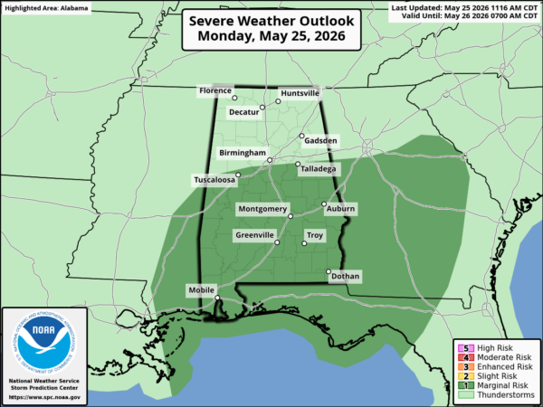
RADAR CHECK: Large areas of rain continue to move across Alabama on this Memorial Day. SPC has introduced a very low end “marginal risk” (level 1/5) of severe thunderstorms for the southern 2/3 of Alabama this afternoon and early tonight.
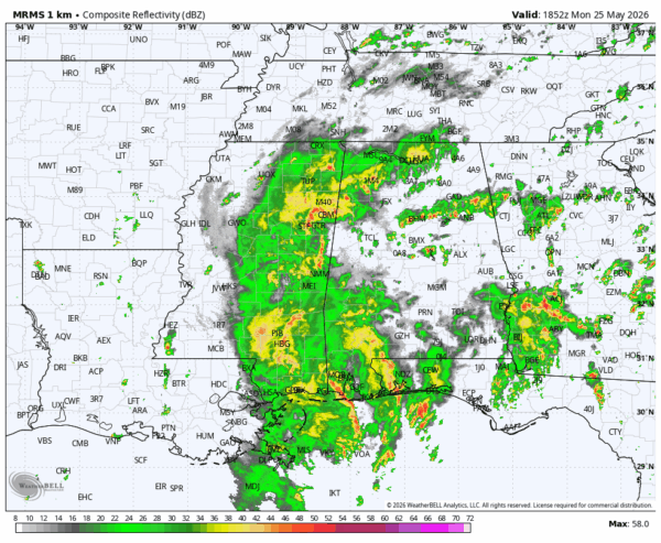
But the main threat comes from flooding; a flash flood watch is in effect for much of the state tonight. Thunderstorms will be very efficient rain producers in this environment. Rain will slowly fade across the state tonight.
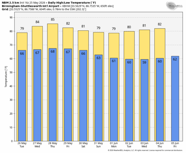
Rain coverage will remain high across the Deep South through the rest of the week with a number of showers and thunderstorms around on a daily basis. Highs will be in the low to mid 80s on most days.
THE WEEKEND: We will maintain the chance of scattered showers and thunderstorms, but we are seeing evidence that the upper ridge will try and rebuild. Warmer air aloft and a more stable airmass should mean fewer showers by Sunday. The first week of June looks drier as well with just a few widely scattered showers and storms around during the afternoon/evening hours. See the video briefing for maps, graphics, and more details.
ON THIS DATE IN 1958: An F2 tornado touched down near Decatur, in Morgan County. One person was injured; boats and boathouses were damaged in a harbor.
ON THIS DATE IN 2008: A large and extremely powerful EF5 wedge tornado devastated the towns of Parkersburg and New Hartford, Iowa. Part of a large tornado outbreak across the Central Plains, the tornado killed nine people and caused around $75 million in damages across its approximately 43 mile path through northeast Iowa.
Look for the next video briefing here by 6:00 a.m. tomorrow…