


Click to enlarge
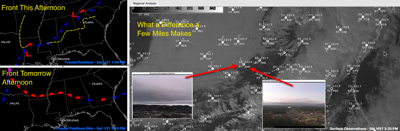
Quite a difference in the weather across the Birmingham area, not to mention across Alabama this afternoon.
Just driving from Trussville to Vestavia, the temperature rose from 57F to 61F on the car thermometer. At both locations, it is still heavily clouded. But an area of clearing further south is giving bright sunny conditions in places like Inverness, as evidenced by the Birmingham and Inverness Skycams superimposed on the visible satellite/surface obs in the left panel.
But go to the Tennessee Valley and you would find a reading of 43F at Muscle Shoals. It’s 41F in Tupelo. The cold front is approaching I-59 at this hour.
The I-20 corridor will get into the middle and upper 40s overnight. Given that, it’s hard to imagine it getting back to the 70s and us experiencing severe weather tomorrow night. But that same front will come back to the north as a warm front as a strong low pressure system lifts into the Great Lakes states.
We will be monitoring for a significant threat of severe weather tomorrow afternoon and tomorrow night across parts of Tennessee, Mississippi and Alabama. For us, it would likely occur after 9 p.m. tomorrow night. Instability levels will be marginal, but there may be sufficient wind shear to make up for the lack of it.
Everyone will want to monitor conditions throughout the day on Sunday as we adjust the forecast.



