


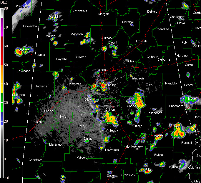
Showers and thunderstorms have developed this afternoon mainly in an arc from Northwest through North Central and into South central Alabama.
The heaviest cell is just west of Pelham in northern Shelby County.
Storms over northern Autaua and Chilton Counties a well as Coosa County have peaked but are still on the strong side.
The stronger storms have heavy rain, gusty winds and lots of lightning.
Everything is moving southeast.
The proximity of the storms has cooled things off just a bit in across Central Alabama with temperatures generally now in t he upper 80s except in showers. It was still 93F at Anniston, where sunshine still prevails in slightly drier air. Same at Huntsville, where it is now 97F. Remember at 11 a.m., they were behind everyone else with 88F while the rest of the state was in the 90s.



