


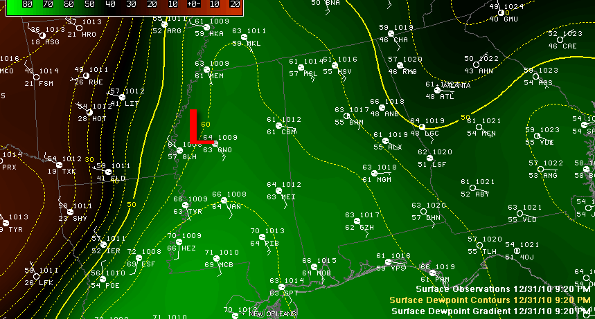
So far so good tonight as the deeper moisture has had a hard time lifting very far into Alabama. This lack of richer moisture will prevent significant severe weather. And the widespread rain that is falling over North and North Central Alabama is helping to keep things under control.
But a fly in the ointment is a developing surface low over West central Mississippi. It is show on the graphic in between Greenville and Greenwood Mississippi. If this low can get organized, it could help to pull the critical 60F dewpoints northward and we could have problems overnight with some isolated tornadoes.
Even as we speak, storms are intensifying in West Central Mississippi to the south of that low and ahead of the cold front. New severe thunderstorm warnings are being issued and a tornado warning was just issued for Holmes County in Mississippi. A severe thunderstorm warning was just posted in Northeast Mississippi as well. If the moisture levels do increase over Alabama, we could see a long night of severe thunderstorms and the possibility of a few tornadoes.
If the low remains weak, it will be a heavy rain event with a just few severe thunderstorms during the predawn and morning hours on Saturday.
The NWS is debating whether to issue a tornado watch into Alabama at this time. We will let you know as soon as we hear.
In either case, rainfall amounts will eventually become heavy and flash flood warnings could be required. A flash flood watch remains in effect for North and central Alabama until noon Saturday.
Please stay close to a good source for weather information overnight.



