


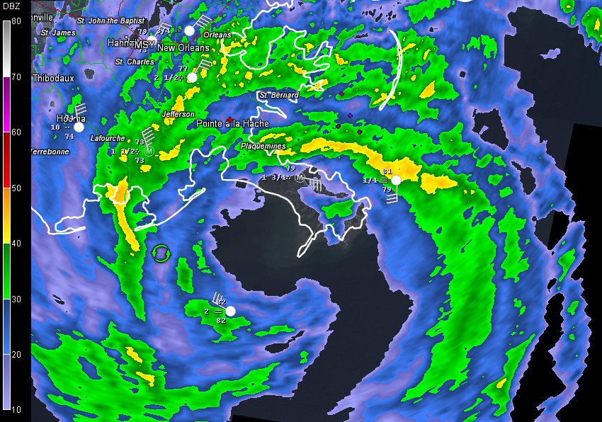
Hurricane Isaac has wobbled westward over the past few hours and the center is over Barataria Bay. Still holding intensity.
FAST FACTS FROM THE 10 PM ADVISORY
———————————————–
LOCATION…29.0N 89.7W
ABOUT 75 MI…120 KM SE OF HOUMA LOUISIANA
ABOUT 75 MI…120 KM SSE OF NEW ORLEANS LOUISIANA
MAXIMUM SUSTAINED WINDS…80 MPH…130 KM/H
PRESENT MOVEMENT…NW OR 310 DEGREES AT 8 MPH…13 KM/H
MINIMUM CENTRAL PRESSURE…968 MB…28.59 INCHES
9 PM OBSERVATIONS
…LOUISIANA…
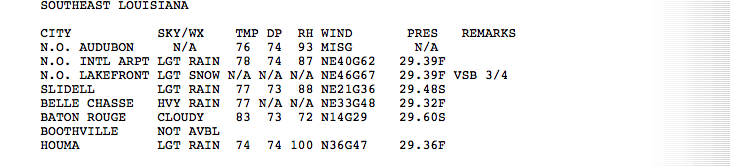
FROM KEN GRAHAM, MIC AT NWS SLIDELL
Report from St. Charles Parish water works that the Mississippi River at Mile Marker 127 has risen 8 to 10 feet since this morning. Confirmed with RFC.
…ALABAMA MARINE
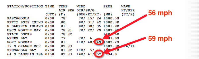
Dauphin Island tide 3.5 feet above…dropping slowly with the astronomical tide…
…FLORIDA
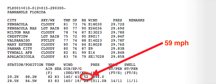
…Pensacola tide 3 feet above normal…falling with low tide.
NEW ORLEANS REPORTS
…I-610 underpass at Elysian Fields is flooded and impassable. Wind blwing down the barricades.
…201,000 without power in Louisiana
…10 foot surge at Shell Beach
…Billy Nungesser, Plaquemines Parish President, reported Isaac was much worse than Gustav over the southern part of his parish. Reports he has lost his roof. He also reports that the storm surge is coming up the Mississippi River.
…A huge rainband is approaching New Orleans now.
…Winds have gusted to 67 mph at Lakefront Airport in New Orleans.
MISSISSIPPI COAST
…Tide 6.5 feet above normal at Waveland. NWS Slidell reports gage is rising rapidly now. Not good.
FROM PATRICK MARSH
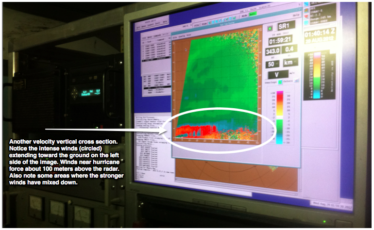
WeatherBrains alum Patrick Marsh sent this picture of the OU mobile radar setup in Houma.
ELSEWHERE IN THE TROPICS
…Tropical Storm Kirk has formed in the far eastern Atlantic. No worries though. It will move out to sea.


