Recon mission 13 into Tropical Storm Fay is complete and the plane is enroute back to Keesler. Mission 14 was a high altitude Gulfstream mission to sample the atmosphere around the storm. This data will be used to enhance the data for the models 00z run this evening.
Hopefully, the data will help to better resolve the forecast for Fay. Early indications are that the ridge is eroding and the northward turn will happen.
Fay is slowly getting better organized, and there are signs that convection is trying to form near the center which is south of the Cuban coast. The central pressure has fallen to 1001 mb.
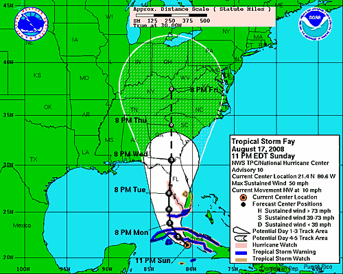
The center of Fay is located near 21.4N, 80.6W, or about 235 miles SSE of Key West.
The storm is moving northwest at 10 mph.
Top winds are 50 mph. Some slow strengthening is forecast as the storm prepares to cross Cuba. It is over very warm water. While there is some wind shear now, it is expected to relax as the storm enters the Gulf.
After crossing Cuba, it should be able to intensify until landfall. It should become a hurricane by Tuesday morning. It is not expected to top 80 mph.
There is still a wide spread in the early guidance tonight…here are the plots…
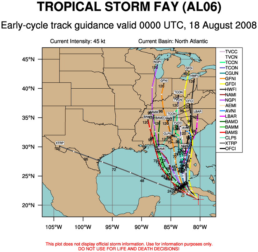
Still, the NOGAPS and some of the BAM models depict a more westerly track, while many of the other models still insist on a west coast of Florida landfall.
The official track carries Fay over the Keys tomorrow night then to near Tampa Tuesday night.