


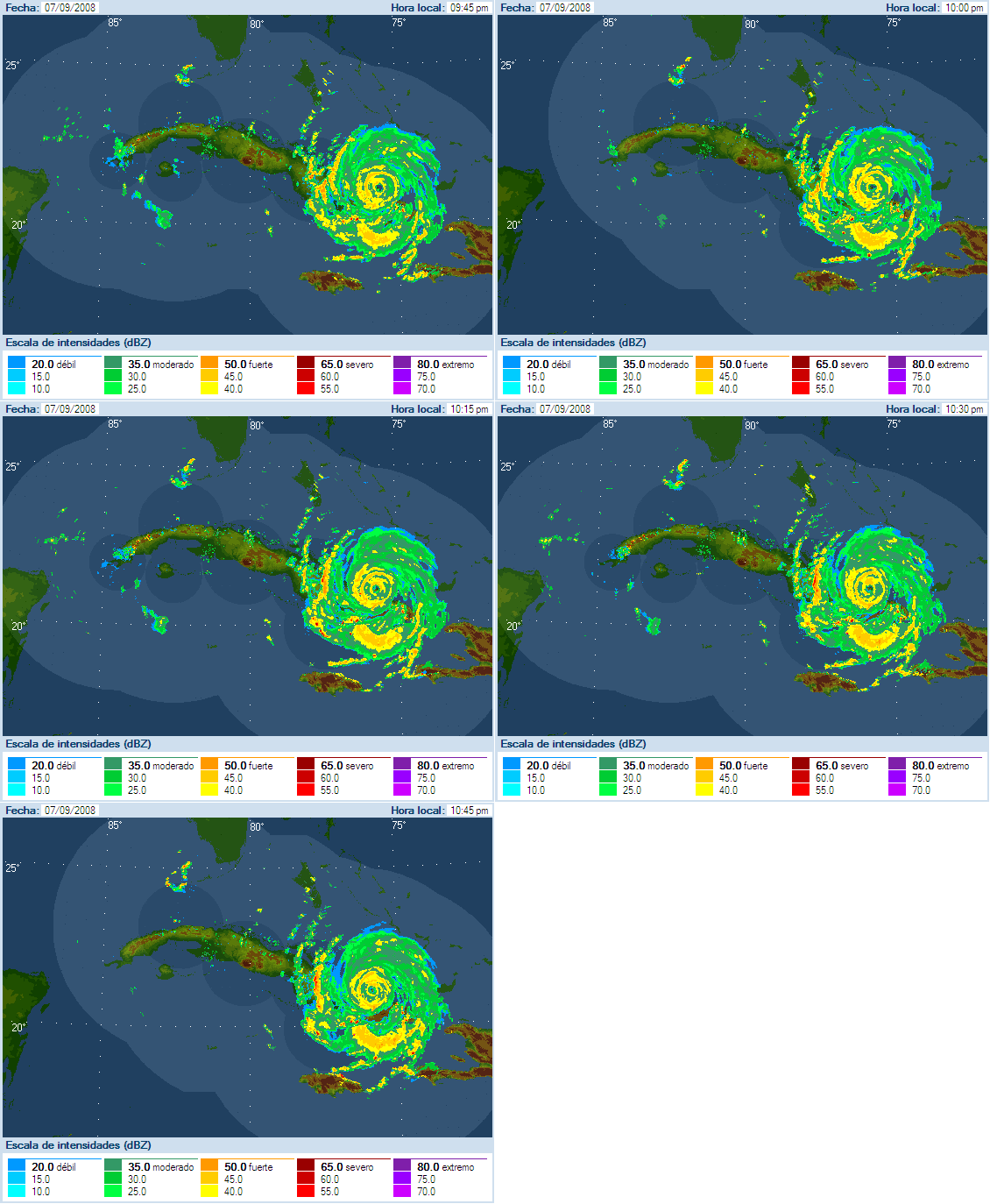
FAST FACTS…10 PM CDT
LOCATION: 21.1N/75.8W
MOVEMENT: W-13 MPH
MAX WINDS: 120 MPH
CENTRAL PRESSURE: 945 MB
…If Ike continues on its present westerly course, it will spend less time over Cuba and get back over water more quickly. This could lead to less weakening than is currently anticipated. Ike is expected to begin a more west northwestward track tonight and on Monday, keeping the center of land for 24-36 hours.
…Large swells from Ike will affect the East Coast of the U.S. with high surf and dangerous rip currents.
…I fear that the Florida Keys will still see significant storm surge, even though they are unlikley to see hurricane force winds, and tropical storm force winds may be limited to the lower keys, depending on the track.
…Recon has been out of the storm for several hours. More flights are scheduled overnight.
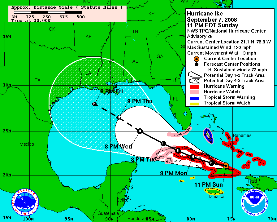
…The official track now is more directly aimed at the Texas/Louisiana border area over to Houston. But the cone of uncertainty extends from Pensacola to Brownsville. The evening NAM shows a big trough over the Southwest by Wednesday. But it it cuts off into a closed low, it could anchor the pattern in place and slow the eastward progression of the trough.
…Sea surface temperatures over the Gulf are sufficiently warm to maintain the hurricane after it emerges, and over southern Gulf, we could see some rapid intensification over high oceanic heat content water.
…Wind shear values are light over the Gulf, averaging 10 knots, which will allow for strengthening.
…Affects on Alabama: An easterly flow situation will set up over our area on Monday, bringing a slight chance of showers or storms to the area for the afternoon and into the overnight. A shortwave trough will swing out of the Rockies on Tuesday, pushing a front our way and bringing additional shower and storm chances. As it passes us by to the north, it appears that a shortwave ridge will build back in over Alabama and the Deep South. As Ike encounters this ridge by Thursday, the hurricane will take a jog to the left. But by Friday, a bigger trough will be digging down out of the Rockies. It will be pushing a more substantial front to the southeast. Ike will respond by turning northwest and then north. Landfall will depend on the magnitude and speed of the turn, but it looks like the Upper Texas coast and Southwest Louisiana will be prime candidates for it come Saturday night. It will be an intense hurricane. After making landfall, the low will then move northeast through Central Louisiana and into Mississippi over the weekend, spreading wind and heavy rain along with it. We will get our share of at least the rain it this rationale works out, likely in the Sunday night or Monday time frame.



