Daily Weather Briefing
Sunday, February 22, 2026
ALABAMA THIS MORNING
A clear, windy morning greets Alabamians as they wake this Sunday. Winds are currently gusting around the low to mid 20s north and 30s south. This is making our actual temperature: low to mid 30s north, upper 30s and low 40s centrally, and mid to upper 40s in the south, feel around 10 degrees colder.
ALABAMA 7 DAY FORECAST
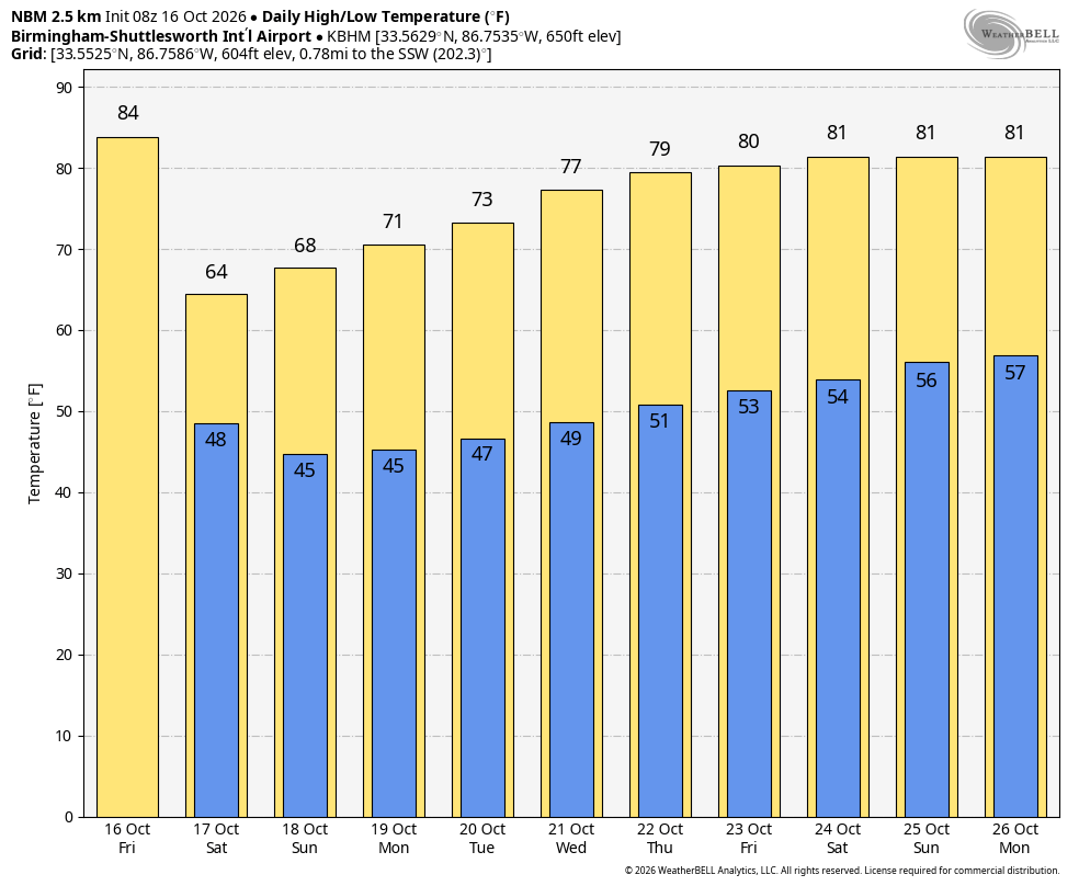
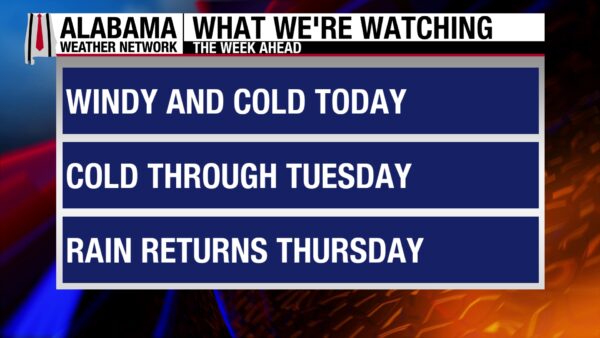
Today will be cool and windy behind yesterday’s cold front. Lows will fall very low tonight, and strong winds will make them feel colder. Tomorrow will be the coldest day of the week, but winds will begin to die down slightly in the afternoon. Tuesday, highs begin to moderate slowly, then they jump up Wednesday. A cold front will sweep through the state and bring decent rain chances Thursday. Lower rain chances stick around Friday and Saturday as one cold front moves out, and another prepares to move in.
WINDY START TO WINTER TEMPERATURES
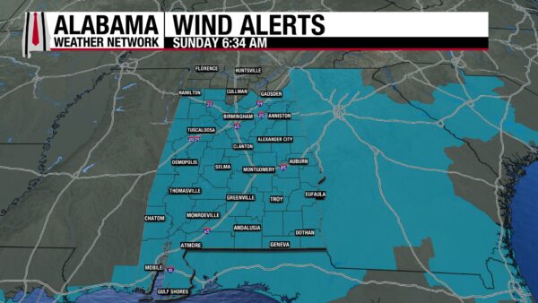
Winter’s stopping by for the next few days to remind us that it’s not done quite yet. The big story today is about the wind. In north Alabama, winds will gust from 20-25 mph, with the potential to reach 30 mph. The area will stay mostly below the Wind Advisory Criteria, but one could be issued if winds gust to 35 mph. North-central through south Alabama is under a Wind Advisory already, with wind gusts reaching 35-40 mph. The advisory is in effect until this evening, ending around 5 p.m. CST in the southwest, 6 p.m. centrally, and 7 p.m. CST in the southeast. Skies will be mostly clear today, with the north-northeast expecting some cloud cover this afternoon. Highs will range from the mid 40s north, and the upper 40s to mid 50s farther south. Wind chill temperatures, however, will be in the 30s in the northern half of the state and the 40s in the southern half.
VERY COLD NIGHT
Clear skies will allow for decent cooling tonight, and lows will fall to the lower 20s north, mid 20s centrally, and upper 20s to low 30s south. Although winds will keep the actual low “warmer” than it could be, they will make wind chill temperatures very cold, ranging from the low teens north to mid-teens centrally to upper teens and low 20s south. Prepare your home for a freeze, and make sure you protect your plants, pets, and pipes.
WINTER SETTLED BY MONDAY
Winter will be set in by Monday and will keep highs to the upper 30s and low 40s north, mid 40s through south-central Alabama, and the upper 40s to low 50s south. Winds will still be strong in the morning, but will fall to wind gusts into the teens by the afternoon. Skies will be clear, but will do little in terms of providing us with any warmth.
MILDER TUESDAY AND WEDNESDAY
Tuesday brings the beginning of a warmup, with clear skies and highs in the low 50s north and upper 50s south. Winds will finally die down as a high-pressure system sweeps across the south.
Wednesday will be much warmer, as highs will climb to the mid to upper 60s in the northern half, and the lower 70s in the southern half.
RAINY THURSDAY THROUGH SATURDAY
A cold front will sweep through the state, bringing medium to high rain and thunderstorm chances on Thursday. 0.1”-0.75” of rainfall should accumulate, with the most falling in northeast Alabama. The highs will be in the mid to upper 60s north again, and the low to mid 70s south.
Friday, the higher rain chance will stick to the south as the cold front will be just off the coast. The chance for rain is not zero further north, however. Highs will climb to the low to upper 60s through south-central Alabama, and the lower 70s in the south.
Low rain chances everywhere Saturday, with highs in the mid to upper 60s north and low 70s south.
WINDY BEACH
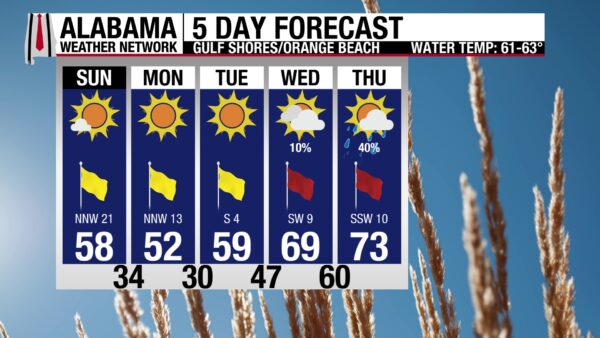
Winds will blow at 25 mph from the north but will gust up to 40 mph. This may make enjoying the sandy shores difficult. The rip current risk is moderate, the surf height is around 3 to 4 feet, the UV index will be high, and the high will be in the upper 50s, but feel colder because of the wind.
WEATHERBRAINS 1049
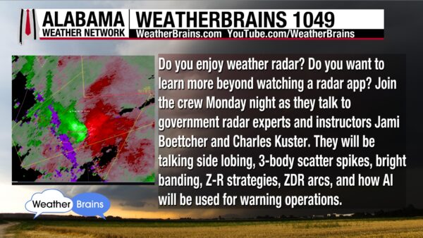
Tomorrow’s WeatherBrains episode features Jami Boettcher and Charles Kuster, two radar experts. Topics will range from side lobing, bright banding, AI, and more. Watch the episode HERE or listen wherever you get your podcasts.
TODAY IN WEATHER HISTORY
February 22, 1945 – The Japanese Wartime Balloons
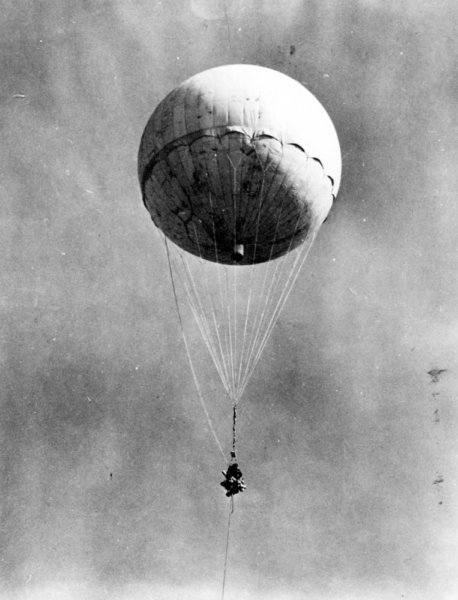
On February 22, 1945, Rancher Kenneth Hamilton in Sheridan County, Nebraska, noticed a balloon floating eastward. He said it, “looked like an orange ball with the sun shining on it.” As he watched it, “it turned into a cloud of smoke and went to the ground.” The balloon he saw was one of nine-thousand hydrogen-filled, paper balloons launched to carry small bombs to North America. They were made by the Japanese military, designed to travel to America, explode, and cause massive wildfires that would divert attention and resources from the war effort. They rose to 30,000 feet and were transported by the jet stream, an area of stronger upper-level winds in the atmosphere. They travel from west to east, so they were a great transport system to get the balloons across the Pacific Ocean. The balloons carried timing devices to release the bombs and destroy the envelope. Parts of five balloons were recovered in Nebraska. A total of 285 such incidents were reported in the U.S. from February to May 1945. They caused six fatalities, all coming from an explosion that killed a woman and her five children in Bly, Oregon, on May 5th. They also caused a few minor fires.
IMAGE(S) OF THE DAY
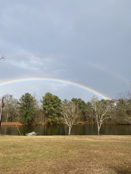
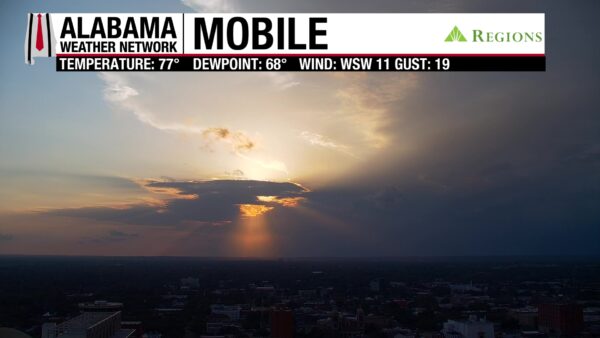
We have two beautiful Images of the Day today. The double rainbow was taken by Skywatcher James Micetich in Fadette. The Mobile cam captures yesterday’s storms in the distance. Super cool!