


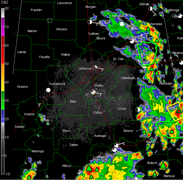
Showers and thunderstorms continue over East Alabama this afternoon.
The mass is increasing in coverage and intensity as it edges slowly westward while individual cells stream north northwestward.
They are moving very slowly, and as a result, are producing heavy rainfall.
A flash flood warning is in effect for Calhoun County. Another is in effect for Lee County, in the Auburn/Opelka area.
A severe thunderstorm warning is in effect for Chambers County.
Over South Alabama, a huge mass of heavy rain and thunderstorms was building northward. Coffee County has a flash flood warning and there is a severe thunderstorm warning for a small part of Lowndes and Wilcox Counties.
A severe thunderstorm warning is in effect for Clarke County for a strong storm south of Whatley.
The airmass over the state is prime for rain and strong to severe pulse type thunderstorms. They can produce hail and damaging winds. Even in areas that saw morning rains, clearing has pushed temperatures into the upper 70s to near 80F and that has allowed instability levels to climb back into the 1000-1500 j/kg range. Those instability values will edge even higher through the rest of the afternoon.
The Storm Prediction Center has issued a severe thunderstorm watch for this afternoon for South Central and South Alabama. It is valid until 7 p.m. CDT



