


Omaha dodged a bullet in the tornado department tonight as a supercell thunderstorm with a history of producing tornadoes morphed into a high precipitation beast of a storm that wrapped up into a large mesoscale convective vortex.
A powerful rear flank downdraft and gust front raced out ahead of the storm, pounding the Omaha area. Winds gusted to 82 mph at Eppley Airport in Omaha.
OMAHA/EPPLEY,NE (OMA) ASOS reports gust of 71.0 knots from W @ 0051Z KOMA 120052Z 27054G71KT 1/4SM R14R/1200VP6000FT +TSRA SQ FEW030CB BKN100 OVC110 18/17 A2955 RMK AO2 PK WND 27071/0051 WSHFT 0029 RAB10 SLP004 CONS LTGICCCCACG TS SW-OHD-NW MOV NE P0002 T01780167 $
Tornado watches continue tonight from Iowa to western Oklahoma, with severe thunderstorm warnings in the same area ahead of a cold front. There are two surface lows tonight, one moving into Wisconsin and another near Dodge City.
Another round of storms with a severe thunderstorm watch and several severe thunderstorm warnings across Illinois, Indiana and Ohio.
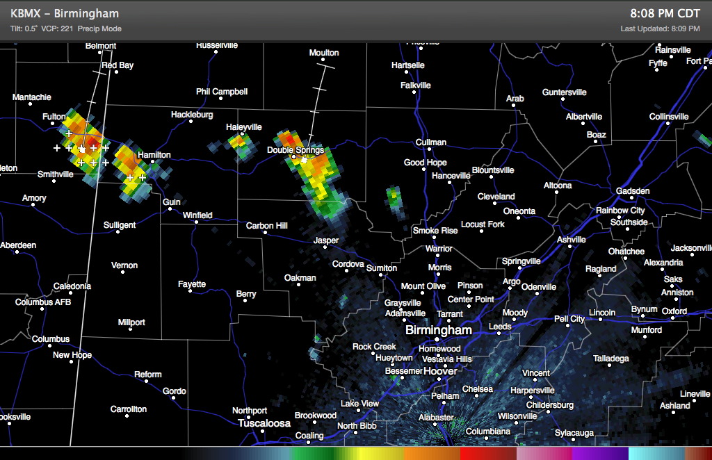
IN ALABAMA
Thunderstorms are near Hamilton and DOuble Springs in Northwest Alabama. There are not strong, but there is lightning and brief heavy rain.



