


LATE REPORT FROM SHELBY CO…
4 ENE Alabaster [Shelby Co, AL] public reports HEAVY RAIN of M3.13 INCH at 09:51 AM CDT — fell in a 2.5 hour window. minor flooding also reported.
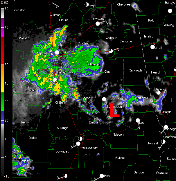
The remnant low that was tropical depression five is clearly evident on radar this morning southeast of Alexander City. You can see it in the image above.
Showers and storms continue this morning thanks to that low, now over parts of Blount, Jefferson Shelby, Chilton, Coosa, Talladega and St. Clair Counties.
Nearly two inches fell at the Shelby County Airport through 9:46 and rain was still falling.
Others are over West Alabama from Lamar and Pickens Counties down to Marengo and Wilcox Counties.
The activity seems to be growing once again and hopefully it will be a wet day across much of the area. I hope that you get your outdoor plans in, but we need the rain and a break in the heat. Could this be the day that the record 90F temperature streak at the Birmingham Airport comes to an end?



