


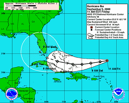
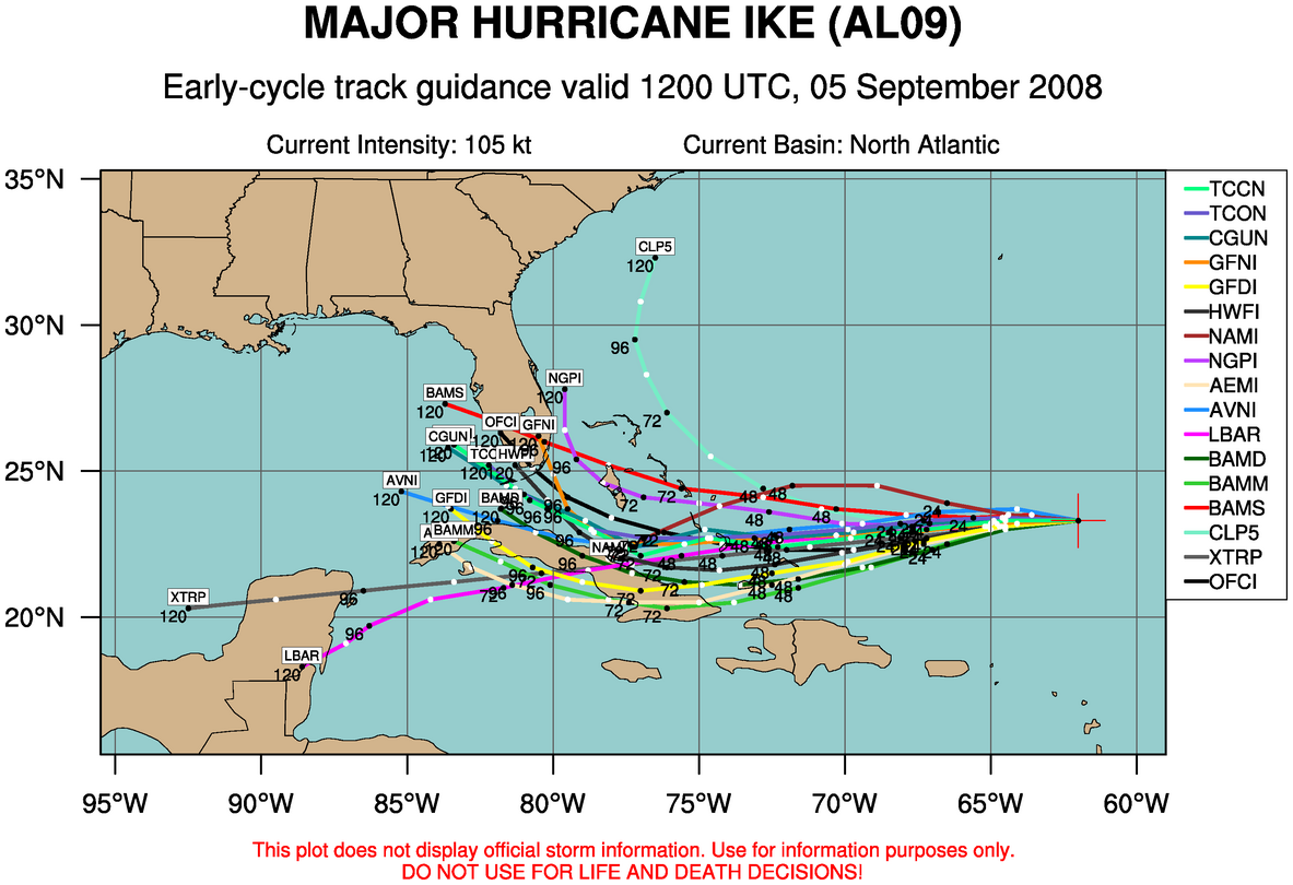
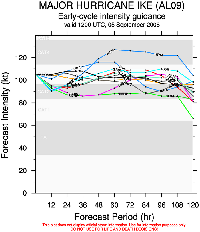
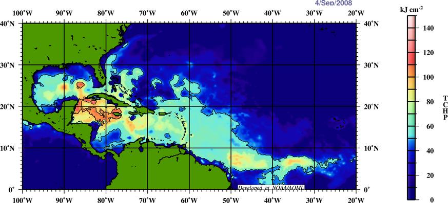
With the models shifting the track of Ike southward today, it looks like it has a decent chance of making it into the Gulf. As James points out, an approaching trough should eventually move Ike north, but if that doesn’t happen until Monday or Tuesday, Ike could become a Gulf storm. This would most likely be a threat from Mobile east to Tampa if it does, with the threat increasing farther east. But, it’s hard to say this early. Even if Ike crosses south Florida, the everglades don’t weaken storms much, if any. Ike should weaken some over the next day or two due to wind shear, but then it is expected to strengthen again by Monday. Below are the model forecast intensities through 5 days, and the tropical cyclone heat potential (deep warm water).
These track forecasts have a large error even at 5 days. Ike could turn north and stay along the Atlantic coast. But, it does now look possible that it could make it to the Gulf, and landfall would be 5-7 days away.



