


…the 0z run of the GFS conitnues to roll in….it is out to 144 hours and shows Ike moving well into the Central Gulf. In fact the track is further west. Ike poses a tremendous threat to the Bahamas, Cuba, South Florida, the Keys and all along the North Central Gulf.
This might be the scene Thursday night…

If you move ahead, the run shoves the hurricane further west in the Gulf before turning it northeastward ahead of a cold front. This could result in generous rains for Alabama. That would be great!
…Air Force recon into Hannah found a central pressure of 981 millibars (up slightly.) An 82 mph flight level wind was observed. That would be very close to hurricane force and I would not be surprised to see Hannah upgarded brefore arrival.
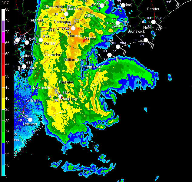
…Hannah is now 60 miles south of Myrtle Beach. Moving north at 20 mph, she should be reach the coast sometime around 2 a.m. So far the only problem reported is a road closed near Georgetown by a 2 foot storm surge.
WINDS ALONG COAST
Charleston…NW 17
Myrtle Beach…ESE 23 G 31
Southport…near Cape Fear…ESE 25 G 39
Check back for an update around 6 a.m…



