AT 10 AM CDT…
LOCATION…21.0N/73.4W
MOVEMENT…W-13 MPH
TOP WINDS…135 MPH (CATEGORY FOUR)
CENTRAL PRESSURE…949 MB
NEW WATCHES/WARNINGS
A hurricane watch has been issued for the FLorida Keys from Ocean Reef south to the Dry Tortugas…
LATEST INFORMATION
Ike is passing over the island of Great Inagua right now. It has caused extensive damage in the Turks and Caicos islands. Next stop Cuba then into the Gulf.
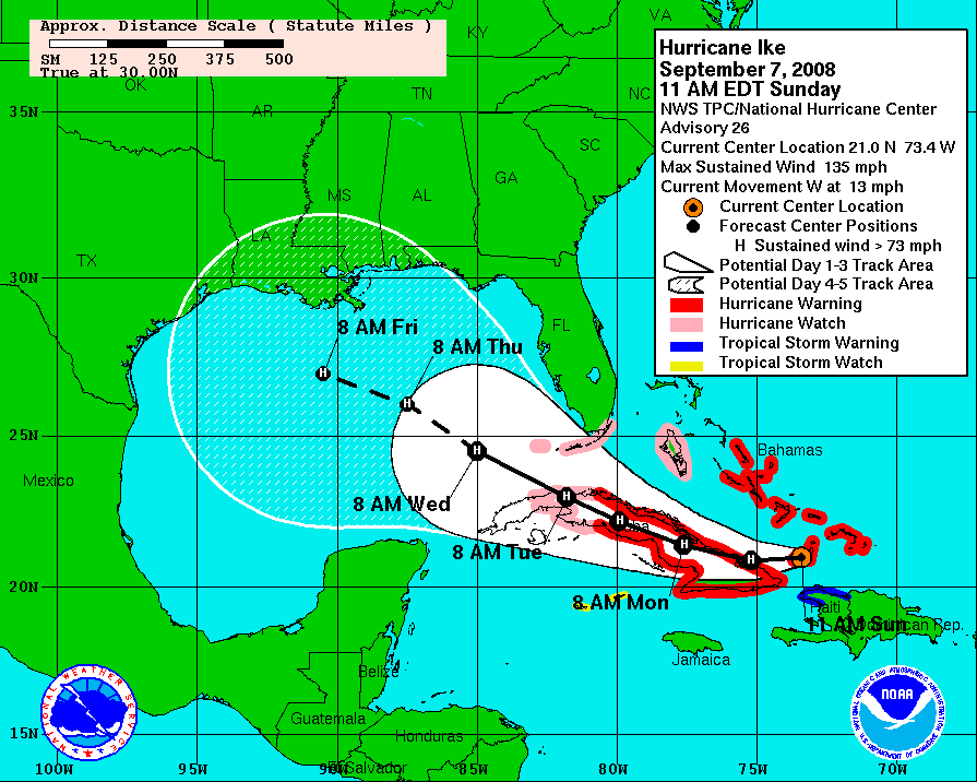
TRACK FORECAST
The forecast track carries the center of Ike directly down the spine of the island nation of Cuba, emerging into the Gulf of Mexico Tuesday morning, then heading on a WNW track to a point 120 mile south of the coast of Southeast Louisian by Friday morning. Lots of uncertainty in the track forecast.
INTENSITY FORECAST
Ike has been basically steady state since last night. A little dry air is evident on water vapor imagery in the process of being pulled int the circulation, which could cause weakening. It also appears to be ready to go through an eyewall replacement cycle, which tends to bring down intensity. But Ike will be a major hurricane when it reaches Cuba.
EVENTUAL LANDFALL
A series of shortwaves will erode the ridge over the United States in the week ahead, allowing Ike to slow and eventually turn. We just don’t know when this will happen and which area will be impacted with a landfall.
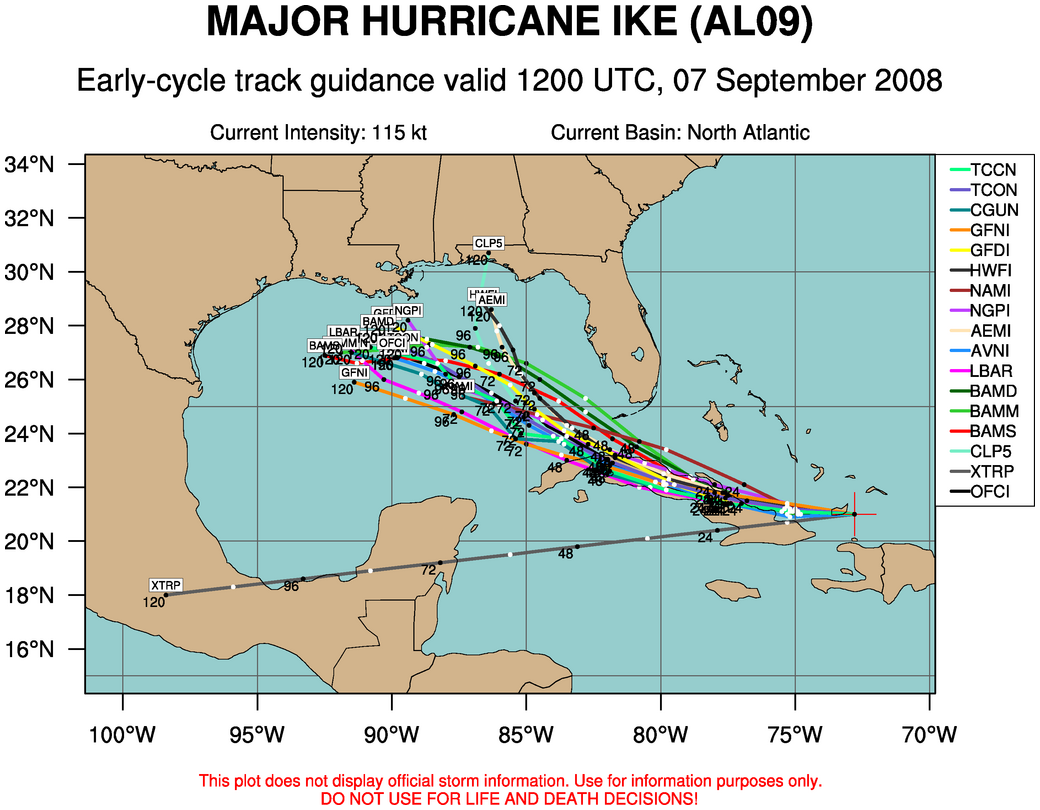
EARLY MODEL DATA
12z plots from the Colorado State site show that the models are still fairly tightly clustered with a west northwest track into the NOrth Central Gulf south of the Louisiana coast.