First is a surface map clearly showing Hurricane Ike. Note how tightly wound he is and what a big area is under his influence
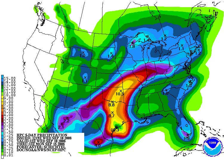
Second is a QPF chart which is an estimate of how much rain in the five dayperiod today until Monday morning. Note:
10 inches Central Texas Coast
8+ inches northward through East Texas
10.50 inches Tulsa and Joplin, Mo.
————————————————————————————————

————————————————————————————————–