As Kevin Knupp and I have learned at UAH, it is sometimes hard to pinpoint the exact location of a cold front. Sometimes, there are multiple surges of cool air and dry air. But, the surface map this afternoon shows the change coming in.
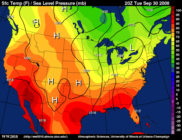
(Univ of Illinois)
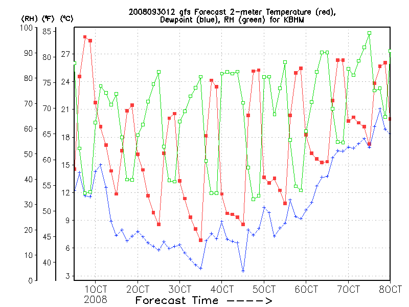
Notice temps here are in the mid 80s, but 60s (yellow) are approaching Paducah, KY, and the counterclockwise flow around the low pressure area is moving that air southward. The GFS plot of its forecast surface temps at BHM over the next week shows the change, with a high tomorrow only near 70 (winds will make it feel like the 60s), and lows in the 40s 3 nights in a row starting Wednesday night. Thursday night should be the coolest, with near calm winds.