


Here is the latest satellite photo of Omar…see the deep convection depicted in black…
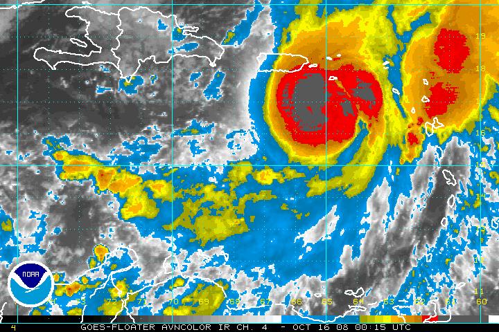
It indicates a strengthening hurricane…now a category two. Omar is about 75 miles SSW of St. Croix.
Top winds are 105 mh. Further intensification is likely. Some category three winds could be experienced at higher elevations. The central pressure is down to 971 mb. The mission that has been flying through Omar is enroute out of the storm now. A new plane is enroute from Barbados.
Movement is northeast at 17 mph. The center should pass near St. Croix later tonight and pass through the Virgin Islands during the early morning hours.
SPOT REPORTS
Christiansted, Virgin Islands…75/75…NE 24…29.65…heavy rain.
Cyrus King Airport, Charlotte Amalie, VI…light rain…76/72…29.72…E 16.
St. Maarten…75/69…E 15…29.80…towering cumulus.



