


The SPC has just issued a mesoscale discussion that includes much of North Central and all of North Alabama warning that a new tornado watch will be required by noon for the area.
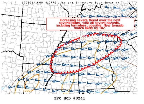
Here is the text of the product:
Probability of Watch Issuance…80 percent
SUMMARY…An increasing severe threat is expected over the next
several hours, with all severe hazards possible, including a few
tornadoes. New tornado watch issuance is likely by 18Z.
DISCUSSION…Mid-level southwesterly flow along a cold front in
middle/western TN has slowed the southeastward movement of the
front. A line of convection along/just ahead of the front has
displayed some strong to damaging wind threat over the past several
hours. The airmass across northern MS/AL ahead of the will continue
to destabilize through the afternoon even with partly to mostly
cloudy skies present. Steep mid-level lapse rates with an elevated
mixed layer are present on the 12Z Jackson, MS sounding and
sufficient low-level moisture across the area will support MLCAPE of
500-1000 J/kg this afternoon. 50-60 kt of effective bulk shear will
support supercell structures both within and ahead of the line,
particularly across northern MS into northern/central AL where
semi-discrete convection is already developing as of 16Z. Although
low-level flow is veered generally to southwesterly, sufficient
curvature in the 0-3 km layer will support effective SRH around
250-300 m2/s2, which suggests at least some tornado threat will
likely develop. Large hail will able be possible with the initial
discrete convection, with damaging winds becoming more probable with
time as thunderstorms congeal into a line.
..Gleason/Hart.. 03/01/2017



