


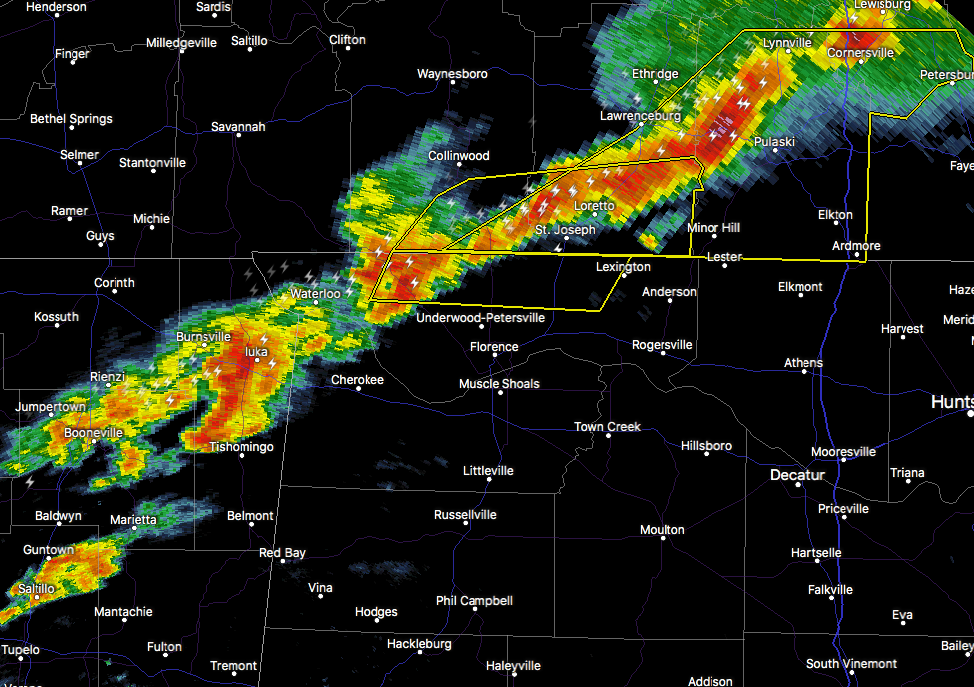
…THE SEVERE THUNDERSTORM WARNING FOR NORTHEASTERN LAUDERDALE COUNTY
WILL EXPIRE AT 1130 AM CST…
The storm which prompted the warning has weakened below severe
limits, and no longer pose an immediate threat to life or property.
Therefore, the warning will be allowed to expire. However gusty
winds and small hail are still possible with this thunderstorm.
______________________________________________________________________________
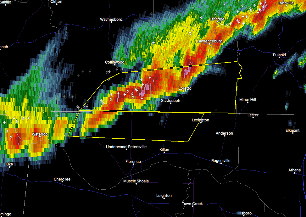
…A SEVERE THUNDERSTORM WARNING REMAINS IN EFFECT UNTIL 1130 AM CST
FOR NORTHERN LAUDERDALE COUNTY…
At 1109 AM CST, a severe thunderstorm was located 9 miles northwest
of Underwood-Petersville, or 14 miles north of Florence, moving east
at 40 mph.
HAZARD…60 mph wind gusts and penny size hail.
SOURCE…Radar indicated.
IMPACT…Expect damage to roofs, siding, and trees.
Locations impacted include…
Lexington, Green Hill, Threet, Zip City and Cloverdale.
PRECAUTIONARY/PREPAREDNESS ACTIONS…
For your protection move to an interior room on the lowest floor of a
building.
______________________________________________________________________________
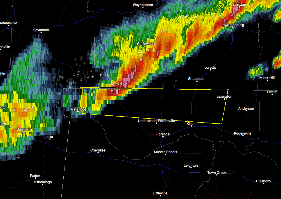
The National Weather Service in Huntsville Alabama has issued a
* Severe Thunderstorm Warning for…
Northern Lauderdale County in northwestern Alabama…
* Until 1130 AM CST
* At 1057 AM CST, a severe thunderstorm was located 10 miles east of
Walnut Grove, or 16 miles east of J P Coleman State Park, moving
east at 50 mph.
HAZARD…60 mph wind gusts and nickel size hail.
SOURCE…Radar indicated.
IMPACT…Expect damage to roofs, siding, and trees.
* Locations impacted include…
Lexington, St. Florian, Underwood-Petersville, Green Hill, Threet,
Zip City, Kingtown and Cloverdale.



