


The severe weather threat over Northwest and North Central Alabama appears to be increasing late this morning.
There is no cap over a low end moderately unstable airmass over all of North and Central Alabama. CAPE values are running 750-1,250 joules now. There is over 60 knots of speed shear, meaning organized storms.
And there is at least 250 m2/s2 of low level helicity over the northern third of Alabama.
This is yielding a significant tornado parameter of 1-2 across the area.
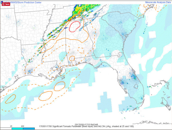
Watch out for these storms over northern Mississippi that will be entering Northwest and West Central Alabama over the next two hours.
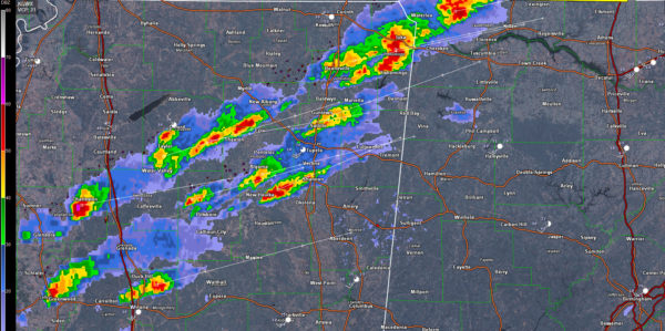
They are moving quite quickly today at nearly 60 mph from WSW to ENE.
As they move into the unstable and energetic air over North and Central Alabama, the tornado threat will increase.
A tornado watch will be issued soon for areas along and north of the I-20 Corridor.



