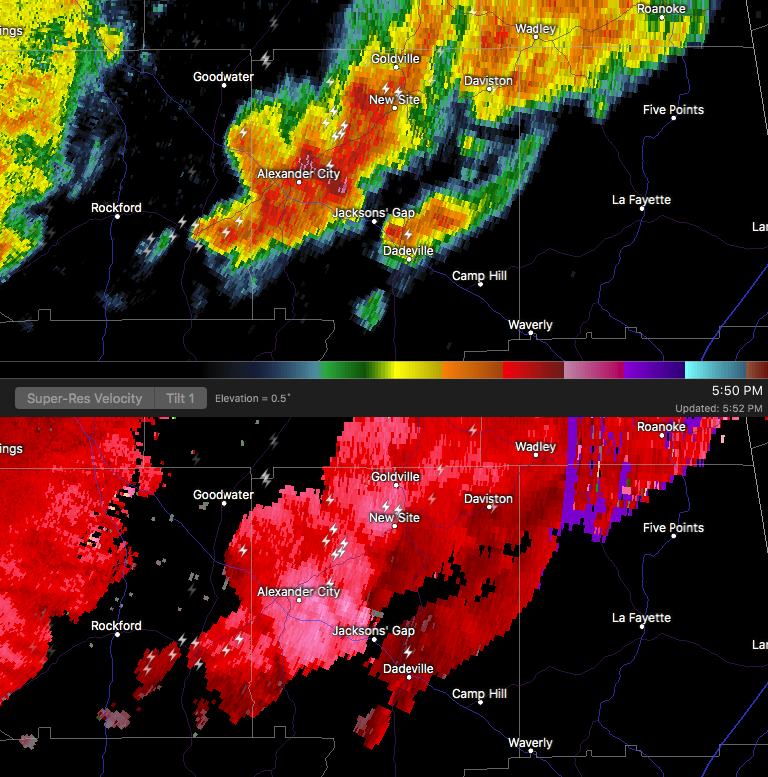
…A SEVERE THUNDERSTORM WARNING REMAINS IN EFFECT UNTIL 615 PM CST FOR NORTHEASTERN TALLAPOOSA COUNTY… At 603 PM CST, a severe thunderstorm was located near New Site, or 10 miles northeast of Dadeville, moving east at 50 mph.
HAZARD…60 mph wind gusts and quarter size hail.
SOURCE…Radar indicated.
IMPACT…Hail damage to vehicles is expected. Expect wind damage to roofs, siding, and trees. Locations impacted include… New Site, Daviston, Horseshoe Bend, Horseshoe Bend National Military Park and Eagle Creek.
Severe Thunderstorm Warning Issued For Parts Of Tallapoosa County Until 6:15PM
Mar 1st @ 5:52 pm

The National Weather Service in Birmingham has issued a
* Severe Thunderstorm Warning for…
Northern Tallapoosa County in east central Alabama…
* Until 615 PM CST
* At 551 PM CST, a severe thunderstorm was located near Jacksons’
Gap, or near Alexander City, moving east at 55 mph.
HAZARD…60 mph wind gusts and quarter size hail.
SOURCE…Radar indicated.
IMPACT…Hail damage to vehicles is expected. Expect wind damage to roofs, siding, and trees.
* Locations impacted include…
Alexander City, Jacksons’ Gap, New Site, Hillabee Creek, Northern
Lake Martin, Daviston, Eagle Creek, Horseshoe Bend and Horseshoe
Bend National Military Park.