


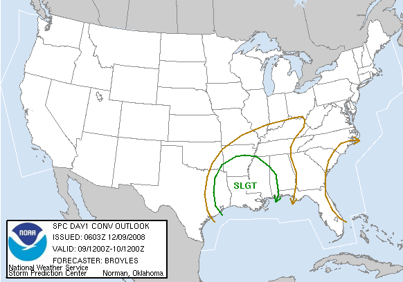
The latest models look a tad more aggressive when it comes to severe weather in Alabama tonight. SPC has extended its slight risk for severe weather eastward into west Alabama.
A surface low pressure area, centered near Oklahoma City early this morning, will move slowly NE today, bringing a cold front toward Alabama. There is also a strong upper-level storm in the southwest US, that will slowly progress eastward, possibly causing another low pressure area to form along the front in Louisiana or Arkansas today.
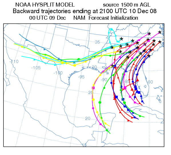
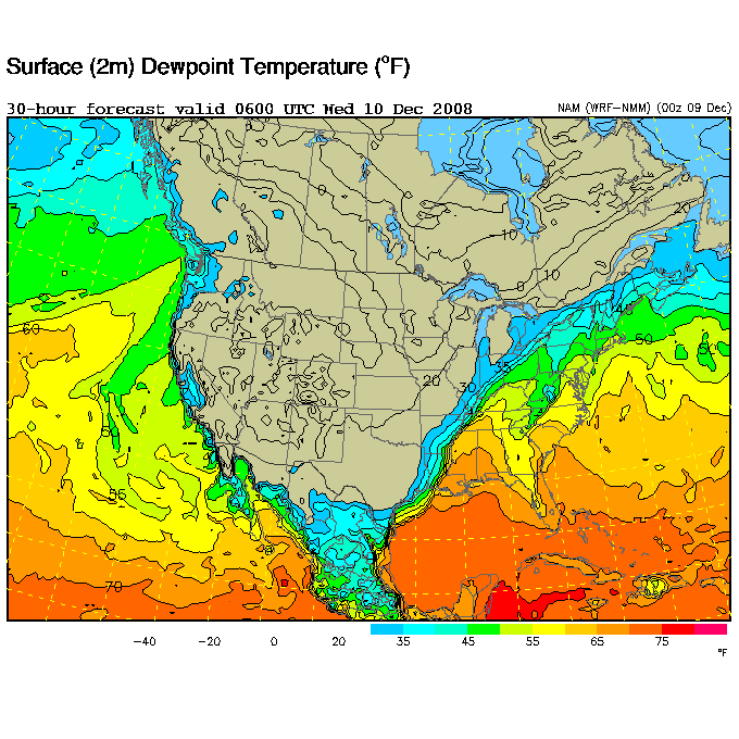
Brisk southerly winds will transport warm, moist air from way out in the Gulf into Alabama today and tonight. Check out the trajectory models (showing where certain air parcels go in a 33-hour period) ending at 3 pm today. Air from way down in the Yucatan Peninsula will make it into North Carolina by late afternoon! This means moisture will be plentiful, considering this is December. Dewpoints in the low 60s may make it as far north as Tennesee, with mid 60s to Tuscaloosa.
With relatively cool surface temperatures (the system will come through during the night), instability will be limited over Alabama, so a widespread outbreak of tornadoes is not likely. However, wind shear will be very high, with helicity values over 300 m2/s2, so there may be a few rotating storms, and an isolated tornado can not be ruled out. Tornadoes will be more likely in Louisiana, Arkansas, Mississippi, and SW Alabama.
The main threats will be straight-line wind. A squall line will likely form and move through BHM after midnight. Winds just 4,000 feet above the surface of 60-80 mph are expected, and any storm downdraft can transport some of this wind down to the surface. So, trees and powerlines may go down tonight.
This is still a developing weather situation. But, with the threat of 60 mph winds, and an isolated tornado, be sure to keep watch on the weather today, and leave the NOAA weather radio on standby overnight.



