


A few quick thoughts from the ABC 33/40 Weather Center…
*Still looks like a chance of severe weather across all of Alabama tonight; possibly as early as 8:00 p.m. in West Alabama, with the bulk of the threat coming from 10:00 p.m. until 4:00 a.m. The prime threat will come from damaging straight line winds, but a few isolated tornadoes are possible based on the forecast hodographs.
*A significant severe weather outbreak is in progress west of Alabama, where a number of tornado warnings have been issued for parishes in Louisiana.
*Beneficial rain is likely for Alabama through Thursday night, with potential for 2 to 4 inches of rain.
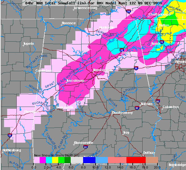
*The 12Z model set puts much of North Alabama in a situation where rain could change to snow Thursday night before it all ends. I am not saying we are going with that forecast at this moment, but the idea is certainly on the table. We are going to look for good analogs in years past. One that comes to mind is the December 1997 snow event in Mississippi and West Alabama.
The 12Z NAM snow accumulation potential is below:
A very interesting forecast call; much more on the afternoon discussion and Weather Xtreme video, which will be posted by 3:30. Stay tuned!



