


Scroll down to see a blog post about the Tuscaloosa tornado on December 16, 2000.
The Arctic cold front that made it as far south as BHM yesterday, and caused freezing rain over parts of Tennesee and Kentucky, has retreated some today. But, with a very large part of North America and the polar regions covered with snow, Hudson Bay frozen, and the minimal amount of sun energy coming in as we near the winter solstice (Sunday 6:04 am CST), tremendous amounts of cold air are in place not only in the U.S., but also in Canada, Alaska, and Russia. Working our way from small-scale to large-scale:
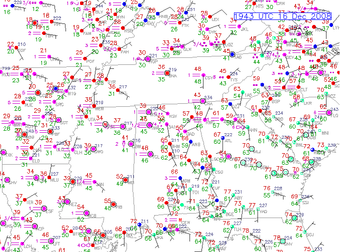
It is 65 in BHM, but 48 in TCL, 39 in MSL, and in the 20s over west Tennessee.
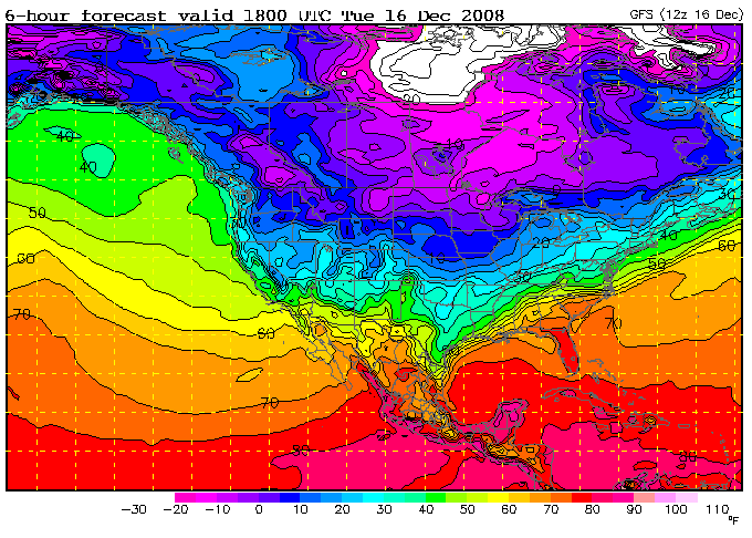
North of the Arctic front, it gets colder the farther you go north. These are noon CST temperatures, but notice it is below 10 degrees over Nebraska, Iowa, and Wisconsin, and below zero in parts of Montana and North Dakota. The white area at the top of the picture indicates temperatures below -20.
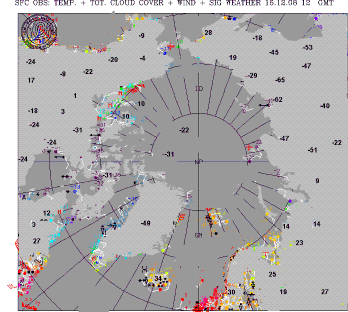
This is a view of temperatures across the Arctic regions at 6 am. Wow. The map had many observations in Celsius, so I made some adjustments and the bold temperatures are in degrees Fahrenheit. You can’t help but notice the -65 in Siberia, with a wide area below -40 over Siberia. It is -31 near the north pole, -49 on top of the Greenland ice cap, -24 on the coast of Hudson Bay, and mainly 0 to -20 over Alaska.
We won’t have to deal with any of this cold air for now, as southerly winds will bring warm air in the rest of the week. BHM will likely reach 70. However, the upper-level ridge keeping the cold air north of us will likely start to move east by the weekend, allowing the cold air to move in Sunday or Monday. Air that cold is much denser than warm air, and it tends to try to spread out anyway, like water on a table, in a “density current”. Air densities over the Arctic are near 1.6, while at BHM now it is 1.22. That’s a big difference.



