


OK, now looking at latest European, NOGAPS, and UKMET, after earlier looking at GFS, Canadian, and NAM (now through Monday morning), we’re getting a little bit of model disagreement here. This will make it challenging. But, a winter storm for Alabama is still possible. I may have spoken to soon earlier when a lot of model data wasn’t available.
We have upper-level impulses in the southern branch of the jet stream that will help form a surface low somewhere near the Gulf coast Sunday night, and at the same time energy in the northern stream will start to phase in with it on Monday, intensifying the low. This low will spread precipitation across Alabama Monday. The low will pull cold air into the state from the north also, and some of the precipitation will fall as snow, with snow likely the farther north you go, and later in the day on Monday.
The track (and intensity) of the low are critical, as they will determine where the precipitation and cold air meet. If the low is too far north, then the cold air will come in as the main precipitation leaves. If the low stays near the coast and is intense, cold air could come in as the precipitation falls to give us snow. Either way, this low will intensify rapidly as it moves up the east coast, bringing very cold air into Alabama. Also, the upper-level part of the storm may be strong enough to produce 1″ or less of snow in BHM even if we don’t get in the main snow band with the system.
In my earlier update I didn’t have several models available, and the NAM is very unsupportive of snow. The consensus of the latest model guidance (with the NAM being the big outlier) does show the low taking a southerly track near the coast, placing the band of snow likely somewhere between BHM and HSV. One thing that bothers me about this system is that the cold air won’t really be in place ahead of time, like it was in March 1993 or January 2000. But, if the low stays far enough south, and intensifies quickly, it can draw the cold air in (Mobile got snow in 1993, even though afternoon temperatures were in the 40s). Not that this will be like 1993.
With all that being said, and considering the upper-level features that will help form this system are still off the west coast of Canada and in NW Mexico, we don’t know for sure! My best guess would be that we will have a cold rain on Monday, with the rain changing to light snow by late afternoon and continuing into the evening. Then, Tuesday will be very cold, with highs only in the 20s and wind chills near zero at times.
Looking at individual models (and their output or likely meaning for Birmingham):
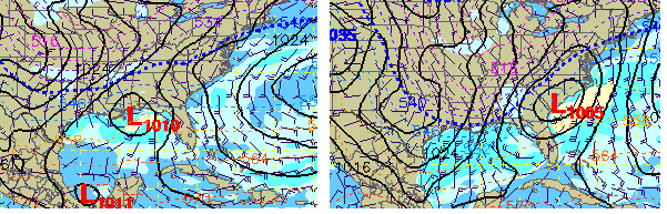
GFS – Rain Monday, changing to light snow Monday night and Tuesday, accumulation 0.5″.
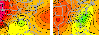
Canadian – Rain changing to snow Monday, accumulation 1″ possible.
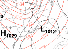
European – Probably the most aggressive, with air cold enough for snow most of the time. We don’t get a lot on precip amounts on this model, but 3″ would be a good guess.
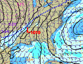
NAM – Low moves west of Alabama, we are in warm sector most of the time, only snow would be light and on the back side of the system.
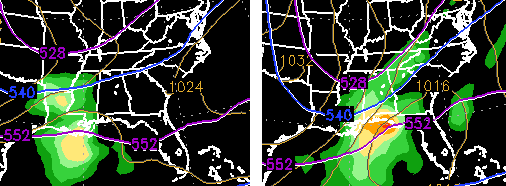
NOGAPS – Rain changing quickly to snow Monday, 1-2″ possible.
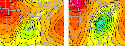
UKMET – Rapidly developing system, so probably snow by Monday afternoon, maybe 1″.
Unless the colder European model is right, the key will be how strong the storm is (upper level and surface), and whether it can overcome the snow-suppressing effect of cold air moving in Monday afternoon enough to produce accumulating snow.
This will be fun!



