


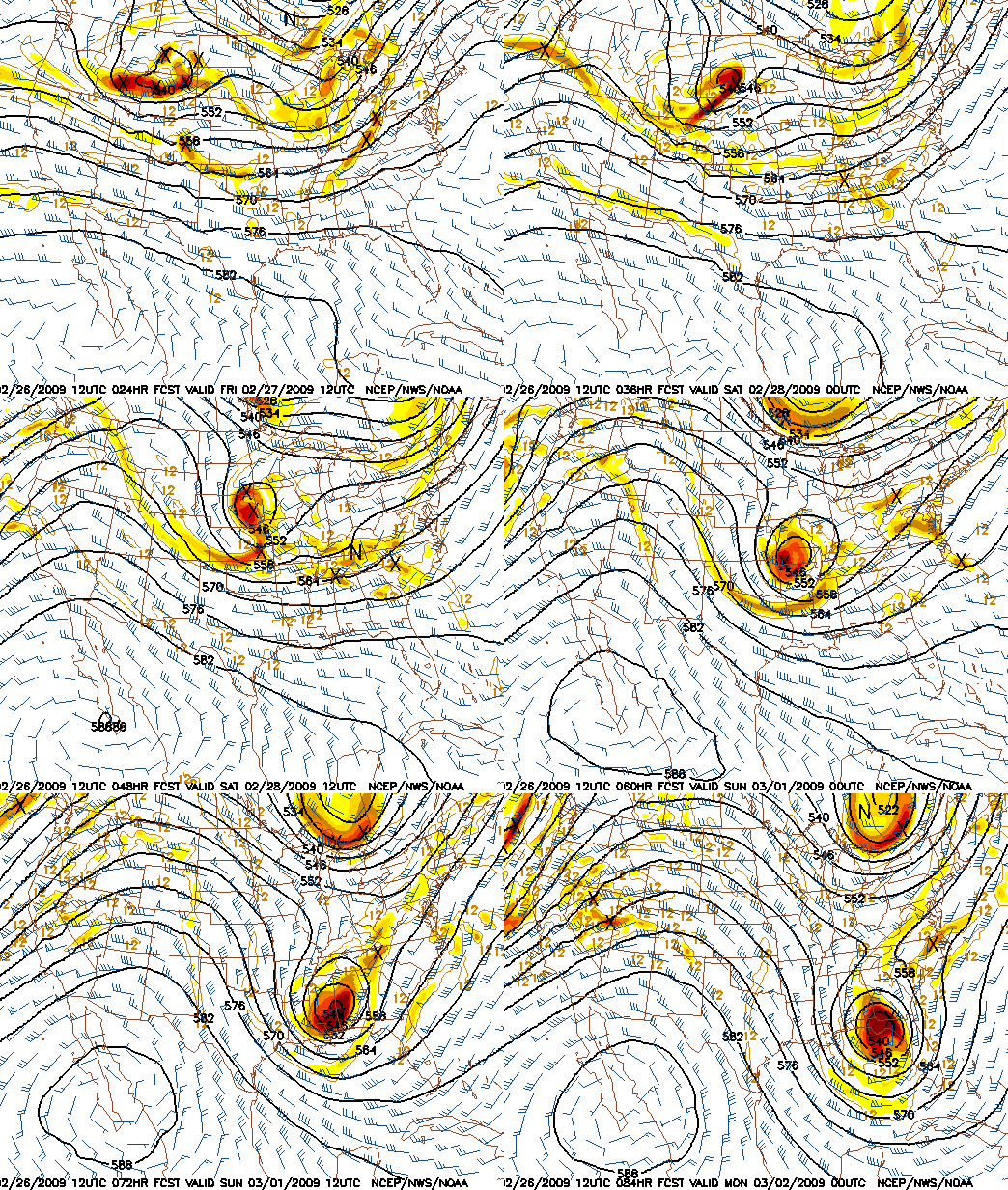
What a forecast over the next 3 days! March may be coming in like a lion, as they say. Maybe not. The above chart is the NAM 500 mb heights and vorticity forecast, every 6 hours, beginning tomorrow morning at 6 am. You can see the weak upper-level disturbances coming in tomorrow, then the strong upper-level low cutting off from the main flow and moving across the area by Sunday. There is lots of fascinating meteorology to talk about here.
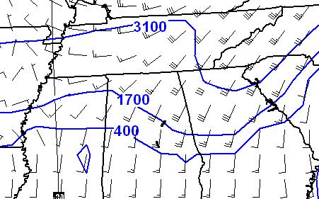
Even though the upper-level dynamics are much weaker tomorrow and tomorrow night, there will be a front stalled out or moving very slowly through north and central Alabama. Warm, moist air will move northward out of the Gulf, and flow up and over this cold air, a condition known as “overrunning” or “isentropic lift”. Cold air is more dense than warm air, and the warm air has a hard time pushing it out of the way. The chart below shows the approximate height of the 291 K isentrope, a decent indicator of the height of the frontal surface. Note how the front slopes upward as you go north. The air tends to follow isentropic surfaces, so with the southerly winds, air that starts near 400 feet over Tuscaloosa quickly rises to near 1,700 feet by the time it gets to Cullman, and 3,100 feet by the time it gets to Nashville. That’s rapidly rising air, causing heavy rainfall.
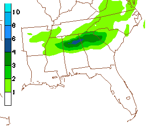
Both models are picking up on this, indicating a band of heavy rainfall amounts over the northern half of Alabama, with about 2″ in BHM, and maximum amounts over 4″ near Cullman. Below is a model rainfall chart through 6 pm Saturday. Hopefully we won’t see any major flooding again, but flooding is possible.
We are also under the threat for severe weather tomorrow. The instability doesn’t look that impressive from BHM north, with rain falling much of the day. However, with wind shear and some cold air aloft, we could see a few severe storms, especially over south Alabama. And, as James pointed out this morning, the front will provide some extra wind shear for isolated tornadoes as far north as BHM. This just doesn’t look like a major tornado outbreak for central Alabama now, but a heavy rain event. We’ll have to keep an eye on it, and you should have a source of weather information handy tomorrow and tomorrow night.
Then comes the upper-level low Saturday night and Sunday. These things are very tough to forecast. An area of cold air forms aloft due to rising air, and it doesn’t move as much as it “propagates” like a wave. In other words, the circulation aloft causes rising air and cooling downstream, so the upper low constantly re-forms. The track of this is hard to forecast. It looks like it will move in here Saturday night and Sunday, with rapid cooling in the atmosphere. According to the models, it will be cold enough for snow in BHM by late Saturday evening, and all day Sunday. But forecasting where the precipitation will occur is the hard part. Right now, at least three models indicate snow in BHM. The NAM shows 4″, the GFS shows 2″, and the Canadian shows 1″. This is likely to change with every model run, and it’s possible that it won’t snow at all in BHM. It seems likely that someone in the southeastern U.S. will get snow out of this, but it could be Nashville, or could even be Montgomery. We don’t know yet. This system looks a little like the one that brought up to 8″ of snow to southern Mississippi in December.



