


A line of strong storms continues eastward across Alabama this afternoon.
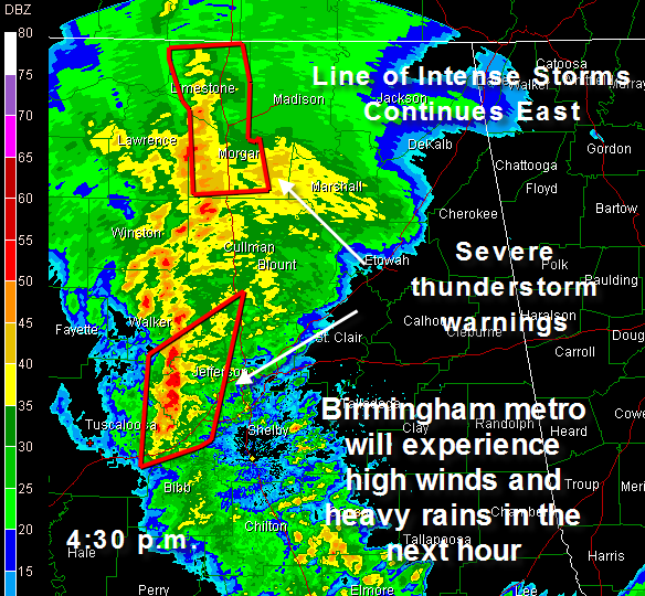
The red boxes indicate severe thunderstorm warnings.
A Severe Thunderstorm Warning continues for Bibb, Blount, Jefferson, Shelby, Tuscaloosa, Walker [AL] till 5:00 PM CDT
A nasty line segment is about to move across much of the Birmingham metro area with the potential for high winds and even an isolated tornado. Heavy rain and dangerous lightning will accompany the storms.
A tornado watch continues for all but extreme East Alabama until 8 p.m. and it will likely be extended into those counties soon.
More development is trying to get organized in Mississippi ahead of a strong cold front, but it is going to have a difficult time reloading in the wake of these strong storms.
So, the line of storms across the state is the main severe weather event.



