


The Storm Prediction Center has issued a tornado watch for South Alabama. It is effective until 1 a.m. CDT.
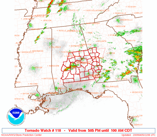
Alabama Counties include: Autauga, Barbour, Bullock, Chambers, Chilton, Coosa, Dallas, Elmore, Lee, Lowndes, Macon, Montgomery, Pike, Russell and Tallapoosa.
A line of strong storms has formed in an area of moderate to high instability over South Alabama. The storms extend from Camden to Fort Deposit to Union Springs. Effective wind shear is over 50 knots in this area, making for organized storms.
To the west, thunderstorms are still trying to form over Central Mississippi ahead of our powerful cold front.
They are looking more healthy from Corinth to New Albany to west of Pontotoc. They have a stripe of 500-1000 j/kg CAPE ahead of the front to work with. This will be sufficient to get them into Alabama, although we hope a general weakening trend will commence after sunset.
Be alert to the latest weather information this evening as the cold front approaches Alabama.



