


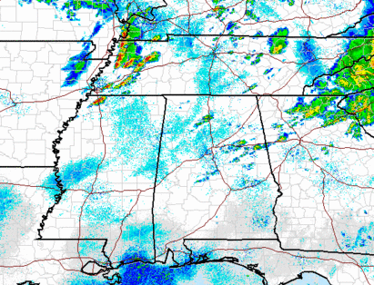
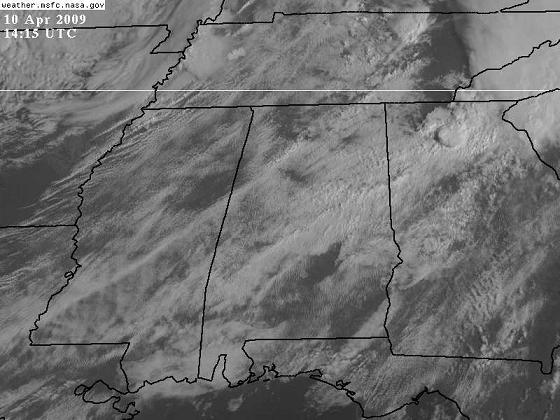
The data are starting to look more favorable for an outbreak of severe weather today, including very large hail and isolated tornadoes, especially over the northern half of Alabama. A cold front extends from a low pressure area in SE Missouri into Arkansas, and this will move east today. Storms are already developing near the front in west TN, and these should continue to expand and develop southward this morning.
Jason Simpson and I were talking about this event, and one of our concerns in large hail. The air is already unstable (see charts below), with lifted indices as low as -7 in MS. With visible satellite pictures showing clouds breaking up over NW AL and MS, temperatures could reach 75 to 80 by this afternoon. With dewpoints in the mid 60s, and very cold upper-level temperatures, the LI could reach -10 in several locations this afternoon. This type of instability will allow any storms that develop to grow rapidly and become severe, and the cold air aloft will make the threat of large hail more likely.
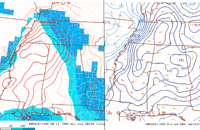
LI and SRH
Notice that the storm-relative helicity is also high, > 400 m2/s2 across most of north and central Alabama. The highest wind shear is farther north, closer to the surface low, and models indicate this will be pronounced by afternoon. Nevertheless, tornadoes may form anywhere from MGM north, given the large instability and moderate wind shear. And, a couple of large tornadoes are not out of the question given the wind shear north of I-20.
Several factors indicate that the highest threat for severe storms will be over north Alabama, from I-20 north. The wind shear will be higher there, and the lift will also be higher, since the low is north of us.
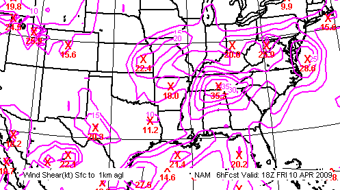
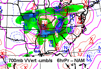
The best shear and lift actually stay north of US-278 on the models. But, given the large instability, severe storms will likely occur at least as far south as TCL, BHM, and ANB.
One more concern is the boundary left over from last night’s rain. Fairly heavy rain fell, as indicated by radar, north of a line from Fayette to Oneonta to Gadsden. In this area, the air may cool a little slower than the air farther south, setting up a boundary that could focus storm development and rotation. It’s hard to forecast these things several hours in advance, but I’m just putting the cards on the table.
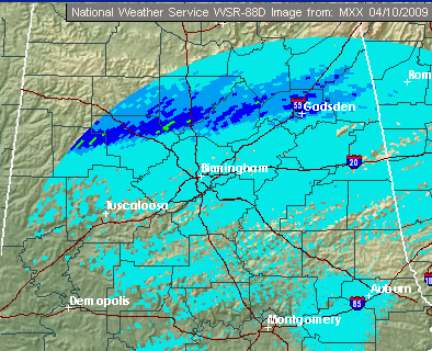
The bottom line is this. Severe storms will develop/move into NW Alabama, probably by noon. These storms will then spread eastward this afternoon. The highest probability of severe weather type is large hail, some maybe up to baseball size. There is also a threat for tornadoes, especially north of a line from Jasper to BHM to Sylacauga.
This event is complicated, and our forecasts for severe weather have not been the greatest this year so far, so it would be a good idea to keep a source of weather information close all day long. This has the potential to become a serious situation, so don’t let the recent hype on marginal events (including that coming from me) cause you to let your guard down. Have a tornado plan, so if a tornado warning is issued, you’ll know what to do.



