


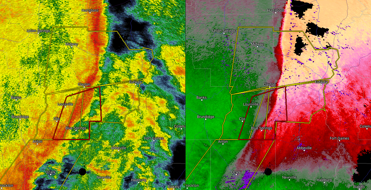

…A SEVERE THUNDERSTORM WARNING REMAINS IN EFFECT UNTIL 715 PM CST FOR SOUTHWESTERN BARBOUR COUNTY… At 658 PM CST, severe thunderstorms were located along a line extending from near Boot Hill to Clio, moving east at 40 mph. A tornado warning is also in effect for this area.
HAZARD…60 mph wind gusts.
SOURCE…Radar indicated.
IMPACT…Expect damage to roofs, siding, and trees. Locations impacted include… Clio, Clayton, Louisville, Tyler Crossroads, Doster and Blue Springs State Park.
The Severe Thunderstorm Warning For Southeastern Pike County Is Cancelled
Jan 23rd @ 6:59 pm

…THE SEVERE THUNDERSTORM WARNING FOR SOUTHEASTERN PIKE COUNTY IS CANCELLED…
The storms which prompted the warning have moved out of the warned area. Therefore, the warning has been cancelled.
Severe Thunderstorm Warning Issued For Parts Of Barbour And Pike Counties Until 7:15PM
Jan 23rd @ 6:29 pm

The National Weather Service in Birmingham has issued a
* Severe Thunderstorm Warning for…
Southeastern Pike County in southeastern Alabama…
Southwestern Barbour County in southeastern Alabama…
* Until 715 PM CST.
* At 628 PM CST, severe thunderstorms were located along a line extending from Troy University to 9 miles southwest of Antioch, moving east at 40 mph.
HAZARD…60 mph wind gusts.
SOURCE…Radar indicated.
IMPACT…Expect damage to roofs, siding, and trees.
* Locations impacted include…
Troy, Brundidge, Clio, Clayton, Louisville, Banks, Tyler
Crossroads, Doster, Antioch, Blue Springs State Park, Tennille, Hamilton Crossroads, Monticello, Tarentum, Brundidge Municipal
Airport and Mossy Grove.



