


Widespread wind damage reports are coming in from Central Mississippi from the huge bow echo that is moving quickly eastward.
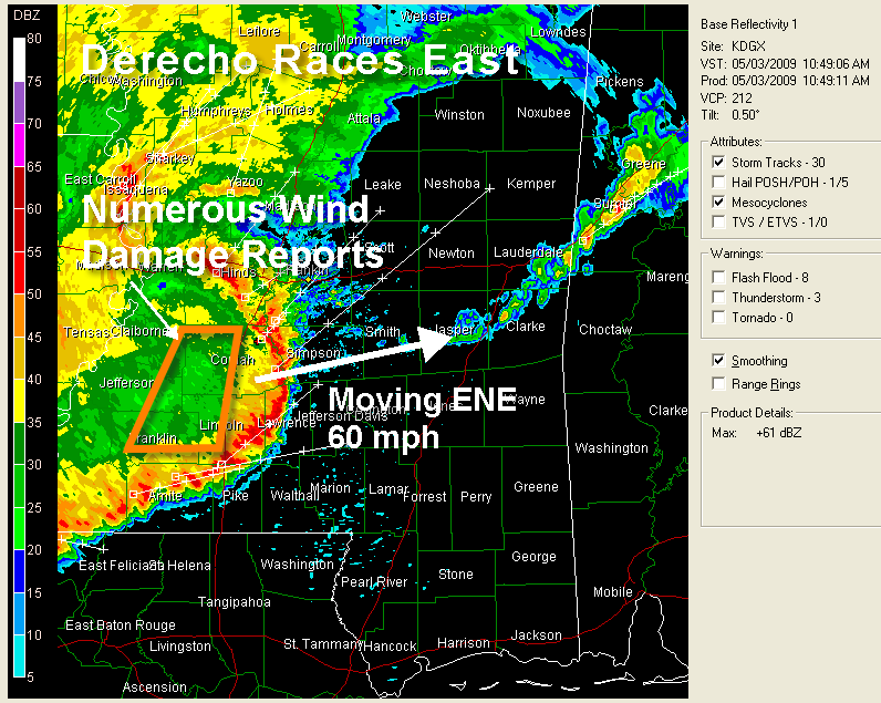
It has slowed a little and expanded. It may be weakening along its northern fringe, where instability levels are lower. Not getting as many damage reports from places like Jackson MS. That is not to say that they may not be occurring and we just aren’t hearing.
The southern part should continue to feed on warm moist inflow from the south. The greatest wind damage threat seems to be over south central and south Alabama from say Butler to Montgomery.
There is a boundary over Alabama from about Macon MS to north of Tuscaloosa to north of Birmingham. Storms may intensify along and south of this boundary as the feature moves into Alabama, and the severe weather threat could be enhanced further to the north into Central Alabama. A severe thunderstorm watch continues for West Central Alabama until 3 p.m.
A new severe thunderstorm watch will be issued for SE Mississippi, much of South Alabama into Georgia ahead of this dangerous wind event.
So get ready for a potentially damaging wind event primarily from Sumter, Greene, Hale and Bibb Counties northeastward through Shelby and point to the east northeast this afternoon. The greatest threat will come further south from Choctaw through Marengo, Wilcox, Dallas, Lowndes and Montgomery Counties and points south. There could also be tornadoes along the line.
To the north, a big area of moderate to heavy rain and thunderstorms will overspread the rest of Central and North Central Alabama. Flooding could become a problem in places that get heavy rain.
Pay close attention to the warnings and radar all afternoon and evening until we get this extended severe weather evnt out of here.



