


A weakening complex of storm moved across the Tennessee Valley this morning. It produced a good bit of heavy rain as well as lots of lightning across Marion, Winston, Fayette, Lamar and Walker Counties. It also prompted an areal flood advisory for those same counties.
Now, a thin line of storms was moving quickly eastward across North and North Central Alabama at 11 a.m. They extend from Lawrence county southeastward through western Winston into northwestern Fayette and Lamar Counties.
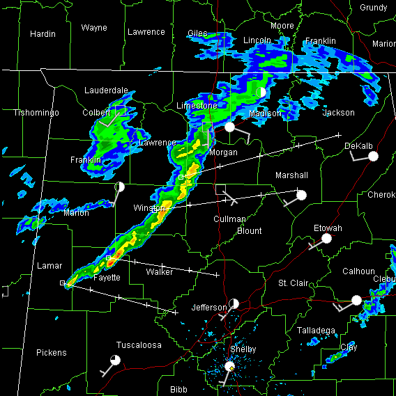
I think this line will develop down into parts of the Birmingham metro area, mainly the northern half of the metro. Brief heavy rain and eventually some lightning as well as gusty winds will accompany the storms.
Sunshine has broken out in the wake of earlier showers in the Birmingham area, and it won’t take much heating to send CAPE values quickly upward. Temperatures were mostly in the 70s and will reach the lower 80s in spots that get a good bit of sunshine.
More storms will form this afternoon across the area. They will be multicellular in variety and some of them will become severe.
Most of North and Central Alabama is now in the latest convective outlook for a slight risk of severe storms today. SO watch out for that as you are out and about.
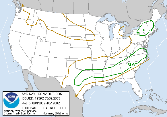
They had split the state out on the early morning outlooks.
Looking back to the west, we see thunderstorm development and this will likely become a mesoscale convective system that will bring another round of storms southeastward into Arkansas, Tennessee, northern Mississippi and eventually Alabama overnight.



