


…THE TORNADO WARNING FOR NORTH CENTRAL TUSCALOOSA COUNTY IS CANCELLED…
The storm which prompted the warning has weakened below severe limits, and has exited the warned area. Therefore, the warning has been cancelled. A Tornado Watch remains in effect until 300 AM CDT for west central Alabama.
A Tornado Warning Remains In Effect Until 2:00 AM CDT For North Central Tuscaloosa County
Apr 14th @ 1:32 am

…A TORNADO WARNING REMAINS IN EFFECT UNTIL 200 AM CDT FOR NORTH CENTRAL TUSCALOOSA COUNTY… At 132 AM CDT, a severe thunderstorm capable of producing a tornado was located near Boley Springs, or 18 miles southeast of Fayette, moving northeast at 50 mph.
HAZARD…Tornado.
SOURCE…Radar indicated rotation.
IMPACT…Flying debris will be dangerous to those caught without shelter. Mobile homes will be damaged or destroyed. Damage to roofs, windows, and vehicles will occur. Tree damage is likely. This tornadic thunderstorm will remain over mainly rural areas of north central Tuscaloosa County.
A Tornado Warning Remains In Effect Until 2:00 AM CDT For Northwestern Tuscaloosa County
Apr 14th @ 1:21 am

…A TORNADO WARNING REMAINS IN EFFECT UNTIL 200 AM CDT FOR NORTHWESTERN TUSCALOOSA COUNTY… At 120 AM CDT, a severe thunderstorm capable of producing a tornado was located over Samantha, or 14 miles north of Northport, moving northeast at 50 mph.
HAZARD…Tornado.
SOURCE…Radar indicated rotation.
IMPACT…Flying debris will be dangerous to those caught without shelter. Mobile homes will be damaged or destroyed. Damage to roofs, windows, and vehicles will occur. Tree damage is likely. Locations impacted include… Samantha, Windham Springs, Whitson and Wiley.
A Tornado Warning Remains In Effect Until 2:00 AM CDT For Northwestern Tuscaloosa County
Apr 14th @ 1:10 am

…A TORNADO WARNING REMAINS IN EFFECT UNTIL 200 AM CDT FOR NORTHWESTERN TUSCALOOSA COUNTY… At 109 AM CDT, a severe thunderstorm capable of producing a tornado was located near Lake Lurleen State Park, or 9 miles northwest of Northport, moving northeast at 45 mph.
HAZARD…Tornado.
SOURCE…Radar indicated rotation.
IMPACT…Flying debris will be dangerous to those caught without shelter. Mobile homes will be damaged or destroyed. Damage to roofs, windows, and vehicles will occur. Tree damage is likely. Locations impacted include… Bankhead Lock And Dam, Samantha, Binion Creek Landing, Tierce Pattton Bridge, Whitson, Wiley, Echola, Windham Springs, New Lexington and Lake Tuscaloosa.
Tornado Warning Issued For Parts Of Tuscaloosa County Until 2:00AM
Apr 14th @ 12:56 am
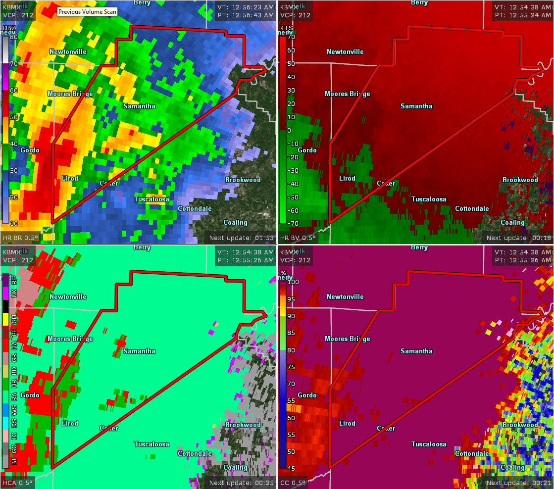

The National Weather Service in Birmingham has issued a
* Tornado Warning for…
Northwestern Tuscaloosa County in west central Alabama…
* Until 200 AM CDT.
* At 1256 AM CDT, a severe thunderstorm capable of producing a tornado was located 7 miles north of Jena, or 7 miles southeast of
Gordo, moving northeast at 45 mph.
HAZARD…Tornado.
SOURCE…Radar indicated rotation.
IMPACT…Flying debris will be dangerous to those caught without shelter. Mobile homes will be damaged or destroyed.
Damage to roofs, windows, and vehicles will occur. Tree damage is likely.
* Locations impacted include…
Coker, Samantha, Bankhead Lock And Dam, Lake Lurleen State Park, Binion Creek Landing, Whitson, Buhl, Windham Springs, New
Lexington, Tierce Pattton Bridge, Wiley, Echola, Highway 69 Bridge, Elrod and Lake Tuscaloosa.



