


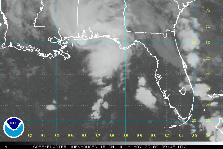
The low over the northern Gulf of Mexico still is showing signs of organization and could become a tropical depression before it makes landfall later today, but it is running out of time.
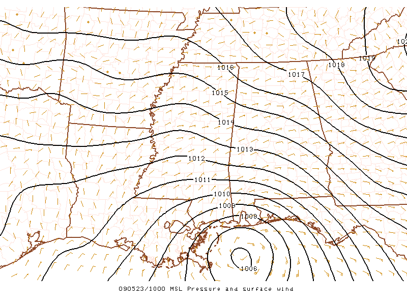
The low is centered about 80 miles south of Mobile this morning, moving very slowly to the north northwest. The minimum pressure in the system is around 1006 mb, indicating it has not dropped much during the night.
Hurricane Hunters are on standby…and if they do have to fly a mission, it will be one of the shortest distances they will ever have to go to get to the center of a system, since they will be coming from Keesler in Biloxi. Doubt they will be needed.
But it doesn’t really matter much whether it actually becomes a depression or not, the impacts are going to be what they are either way. Heavy rain and gusty winds are occurring on the northern side of the system. Sustained winds are running 10-20 mph along the coast with gusts to around 30 mph at Dauphin Island. Buoys are showing 20-30 mph sustained winds.
SPOT REPORTS AT 5 A.m.
CITY SKY/WX TMP DP RH WIND PRES REMARKS
MOBILE REG APT LGT RAIN 70 68 93 NE16 29.79F
FAIRHOPE RAIN 70 69 96 E13 29.76S
GULF SHORES LGT RAIN 71 71 99 E13G22 29.75F
DESTIN LGT RAIN 71 67 87 E12 29.81F
PENSACOLA CLOUDY 71 69 93 E17G30 29.79F
NAS PENSACOLA LGT RAIN 74 70 87 E17G28 29.77F FOG



